You are here: Home > Network List > G - GEOSCOPE Stations List
> Station INU Inuyama, Japan > Earthquake Result Viewer
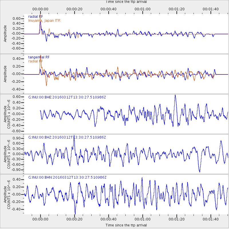
INU Inuyama, Japan - Earthquake Result Viewer
*The percent match for this event was below the threshold and hence no stack was calculated.
| Earthquake location: |
Andreanof Islands, Aleutian Is. |
| Earthquake latitude/longitude: |
51.4/-174.0 |
| Earthquake time(UTC): |
2016/03/12 (072) 13:23:38 GMT |
| Earthquake Depth: |
13 km |
| Earthquake Magnitude: |
5.6 mww |
| Earthquake Catalog/Contributor: |
NEIC PDE/ |
|
| Network: |
G GEOSCOPE |
| Station: |
INU Inuyama, Japan |
| Lat/Lon: |
35.35 N/137.03 E |
| Elevation: |
132 m |
|
| Distance: |
38.3 deg |
| Az: |
264.638 deg |
| Baz: |
49.653 deg |
| Ray Param: |
$rayparam |
*The percent match for this event was below the threshold and hence was not used in the summary stack. |
|
| Radial Match: |
68.77268 % |
| Radial Bump: |
400 |
| Transverse Match: |
45.380035 % |
| Transverse Bump: |
400 |
| SOD ConfigId: |
2361031 |
| Insert Time: |
2017-10-09 15:07:31.369 +0000 |
| GWidth: |
2.5 |
| Max Bumps: |
400 |
| Tol: |
0.001 |
|
Signal To Noise
| Channel | StoN | STA | LTA |
| G:INU:00:BHZ:20160312T13:30:27.510986Z | 2.5746324 | 2.8809754E-7 | 1.11898515E-7 |
| G:INU:00:BHN:20160312T13:30:27.510986Z | 0.8725432 | 1.2028033E-7 | 1.3785028E-7 |
| G:INU:00:BHE:20160312T13:30:27.510986Z | 2.239906 | 1.9214322E-7 | 8.578182E-8 |
| Arrivals |
| Ps | |
| PpPs | |
| PsPs/PpSs | |


