You are here: Home > Network List > IU - Global Seismograph Network (GSN - IRIS/USGS) Stations List
> Station RSSD Black Hills, South Dakota, USA > Earthquake Result Viewer
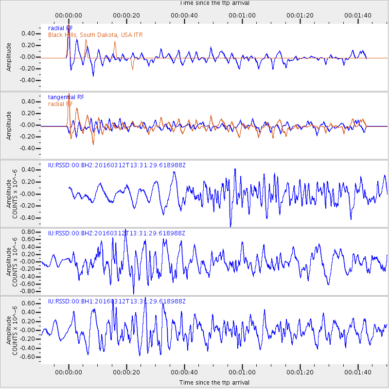
RSSD Black Hills, South Dakota, USA - Earthquake Result Viewer
*The percent match for this event was below the threshold and hence no stack was calculated.
| Earthquake location: |
Andreanof Islands, Aleutian Is. |
| Earthquake latitude/longitude: |
51.4/-174.0 |
| Earthquake time(UTC): |
2016/03/12 (072) 13:23:38 GMT |
| Earthquake Depth: |
13 km |
| Earthquake Magnitude: |
5.6 mww |
| Earthquake Catalog/Contributor: |
NEIC PDE/ |
|
| Network: |
IU Global Seismograph Network (GSN - IRIS/USGS) |
| Station: |
RSSD Black Hills, South Dakota, USA |
| Lat/Lon: |
44.12 N/104.04 W |
| Elevation: |
2090 m |
|
| Distance: |
45.9 deg |
| Az: |
70.361 deg |
| Baz: |
305.083 deg |
| Ray Param: |
$rayparam |
*The percent match for this event was below the threshold and hence was not used in the summary stack. |
|
| Radial Match: |
60.41267 % |
| Radial Bump: |
400 |
| Transverse Match: |
57.10944 % |
| Transverse Bump: |
400 |
| SOD ConfigId: |
2361031 |
| Insert Time: |
2017-10-09 15:08:45.470 +0000 |
| GWidth: |
2.5 |
| Max Bumps: |
400 |
| Tol: |
0.001 |
|
Signal To Noise
| Channel | StoN | STA | LTA |
| IU:RSSD:00:BHZ:20160312T13:31:29.618988Z | 1.9683095 | 2.0017282E-7 | 1.01697836E-7 |
| IU:RSSD:00:BH1:20160312T13:31:29.618988Z | 1.3692553 | 1.795581E-7 | 1.311356E-7 |
| IU:RSSD:00:BH2:20160312T13:31:29.618988Z | 2.0485477 | 1.8993153E-7 | 9.2715204E-8 |
| Arrivals |
| Ps | |
| PpPs | |
| PsPs/PpSs | |


