You are here: Home > Network List > TA - USArray Transportable Network (new EarthScope stations) Stations List
> Station F26K Sheenjek River, AK, USA > Earthquake Result Viewer
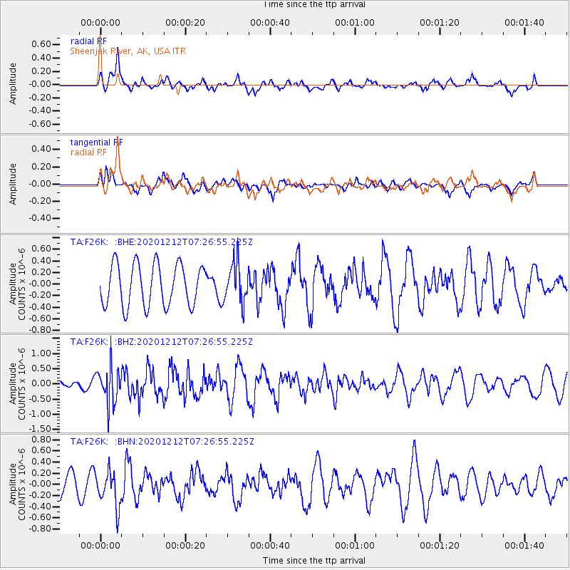
F26K Sheenjek River, AK, USA - Earthquake Result Viewer
*The percent match for this event was below the threshold and hence no stack was calculated.
| Earthquake location: |
Near East Coast Of Honshu, Japan |
| Earthquake latitude/longitude: |
40.1/142.0 |
| Earthquake time(UTC): |
2020/12/12 (347) 07:18:55 GMT |
| Earthquake Depth: |
60 km |
| Earthquake Magnitude: |
5.5 Mww |
| Earthquake Catalog/Contributor: |
NEIC PDE/us |
|
| Network: |
TA USArray Transportable Network (new EarthScope stations) |
| Station: |
F26K Sheenjek River, AK, USA |
| Lat/Lon: |
67.69 N/144.15 W |
| Elevation: |
683 m |
|
| Distance: |
47.6 deg |
| Az: |
29.785 deg |
| Baz: |
273.769 deg |
| Ray Param: |
$rayparam |
*The percent match for this event was below the threshold and hence was not used in the summary stack. |
|
| Radial Match: |
60.331112 % |
| Radial Bump: |
400 |
| Transverse Match: |
44.013096 % |
| Transverse Bump: |
400 |
| SOD ConfigId: |
23341671 |
| Insert Time: |
2020-12-26 08:36:04.869 +0000 |
| GWidth: |
2.5 |
| Max Bumps: |
400 |
| Tol: |
0.001 |
|
Signal To Noise
| Channel | StoN | STA | LTA |
| TA:F26K: :BHZ:20201212T07:26:55.225Z | 3.8161983 | 5.879224E-7 | 1.5405969E-7 |
| TA:F26K: :BHN:20201212T07:26:55.225Z | 2.030137 | 3.2437342E-7 | 1.5977906E-7 |
| TA:F26K: :BHE:20201212T07:26:55.225Z | 0.9434497 | 3.4066642E-7 | 3.6108594E-7 |
| Arrivals |
| Ps | |
| PpPs | |
| PsPs/PpSs | |


