You are here: Home > Network List > US - United States National Seismic Network Stations List
> Station AMTX Amarillo, Texas, USA > Earthquake Result Viewer
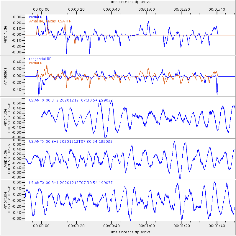
AMTX Amarillo, Texas, USA - Earthquake Result Viewer
*The percent match for this event was below the threshold and hence no stack was calculated.
| Earthquake location: |
Near East Coast Of Honshu, Japan |
| Earthquake latitude/longitude: |
40.1/142.0 |
| Earthquake time(UTC): |
2020/12/12 (347) 07:18:55 GMT |
| Earthquake Depth: |
60 km |
| Earthquake Magnitude: |
5.5 Mww |
| Earthquake Catalog/Contributor: |
NEIC PDE/us |
|
| Network: |
US United States National Seismic Network |
| Station: |
AMTX Amarillo, Texas, USA |
| Lat/Lon: |
34.53 N/101.41 W |
| Elevation: |
1010 m |
|
| Distance: |
85.5 deg |
| Az: |
47.75 deg |
| Baz: |
316.567 deg |
| Ray Param: |
$rayparam |
*The percent match for this event was below the threshold and hence was not used in the summary stack. |
|
| Radial Match: |
48.15282 % |
| Radial Bump: |
400 |
| Transverse Match: |
58.947266 % |
| Transverse Bump: |
400 |
| SOD ConfigId: |
23341671 |
| Insert Time: |
2020-12-26 08:37:47.737 +0000 |
| GWidth: |
2.5 |
| Max Bumps: |
400 |
| Tol: |
0.001 |
|
Signal To Noise
| Channel | StoN | STA | LTA |
| US:AMTX:00:BHZ:20201212T07:30:54.19903Z | 1.06367 | 2.2188681E-7 | 2.0860493E-7 |
| US:AMTX:00:BH1:20201212T07:30:54.19903Z | 1.1002932 | 2.8153113E-7 | 2.558692E-7 |
| US:AMTX:00:BH2:20201212T07:30:54.19903Z | 2.1159062 | 5.1407824E-7 | 2.429589E-7 |
| Arrivals |
| Ps | |
| PpPs | |
| PsPs/PpSs | |


