You are here: Home > Network List > US - United States National Seismic Network Stations List
> Station DGMT Dagmar, Montana, USA > Earthquake Result Viewer
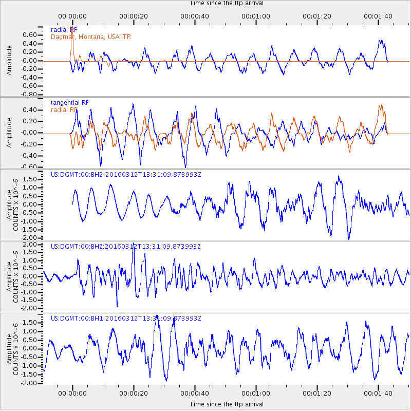
DGMT Dagmar, Montana, USA - Earthquake Result Viewer
*The percent match for this event was below the threshold and hence no stack was calculated.
| Earthquake location: |
Andreanof Islands, Aleutian Is. |
| Earthquake latitude/longitude: |
51.4/-174.0 |
| Earthquake time(UTC): |
2016/03/12 (072) 13:23:38 GMT |
| Earthquake Depth: |
13 km |
| Earthquake Magnitude: |
5.6 mww |
| Earthquake Catalog/Contributor: |
NEIC PDE/ |
|
| Network: |
US United States National Seismic Network |
| Station: |
DGMT Dagmar, Montana, USA |
| Lat/Lon: |
48.47 N/104.20 W |
| Elevation: |
0.0 m |
|
| Distance: |
43.4 deg |
| Az: |
65.27 deg |
| Baz: |
301.345 deg |
| Ray Param: |
$rayparam |
*The percent match for this event was below the threshold and hence was not used in the summary stack. |
|
| Radial Match: |
45.357777 % |
| Radial Bump: |
400 |
| Transverse Match: |
61.857544 % |
| Transverse Bump: |
400 |
| SOD ConfigId: |
2361031 |
| Insert Time: |
2017-10-09 15:10:36.124 +0000 |
| GWidth: |
2.5 |
| Max Bumps: |
400 |
| Tol: |
0.001 |
|
Signal To Noise
| Channel | StoN | STA | LTA |
| US:DGMT:00:BHZ:20160312T13:31:09.873993Z | 2.2506053 | 5.2472876E-7 | 2.3315005E-7 |
| US:DGMT:00:BH1:20160312T13:31:09.873993Z | 0.8895455 | 5.1506635E-7 | 5.7902196E-7 |
| US:DGMT:00:BH2:20160312T13:31:09.873993Z | 0.5809544 | 3.555273E-7 | 6.1197113E-7 |
| Arrivals |
| Ps | |
| PpPs | |
| PsPs/PpSs | |


