You are here: Home > Network List > CI - Caltech Regional Seismic Network Stations List
> Station DGR Domenigoni Reservoir, California, USA > Earthquake Result Viewer
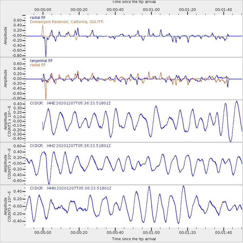
DGR Domenigoni Reservoir, California, USA - Earthquake Result Viewer
*The percent match for this event was below the threshold and hence no stack was calculated.
| Earthquake location: |
Fiji Islands Region |
| Earthquake latitude/longitude: |
-21.0/-179.2 |
| Earthquake time(UTC): |
2020/12/07 (342) 05:25:44 GMT |
| Earthquake Depth: |
598 km |
| Earthquake Magnitude: |
5.6 Mwb |
| Earthquake Catalog/Contributor: |
NEIC PDE/us |
|
| Network: |
CI Caltech Regional Seismic Network |
| Station: |
DGR Domenigoni Reservoir, California, USA |
| Lat/Lon: |
33.65 N/117.01 W |
| Elevation: |
609 m |
|
| Distance: |
80.4 deg |
| Az: |
48.421 deg |
| Baz: |
236.903 deg |
| Ray Param: |
$rayparam |
*The percent match for this event was below the threshold and hence was not used in the summary stack. |
|
| Radial Match: |
82.057655 % |
| Radial Bump: |
337 |
| Transverse Match: |
52.491642 % |
| Transverse Bump: |
400 |
| SOD ConfigId: |
23341671 |
| Insert Time: |
2020-12-27 14:33:21.823 +0000 |
| GWidth: |
2.5 |
| Max Bumps: |
400 |
| Tol: |
0.001 |
|
Signal To Noise
| Channel | StoN | STA | LTA |
| CI:DGR: :HHZ:20201207T05:36:23.51801Z | 2.779883 | 4.2734362E-7 | 1.537272E-7 |
| CI:DGR: :HHN:20201207T05:36:23.51801Z | 1.3286887 | 1.9883211E-7 | 1.4964536E-7 |
| CI:DGR: :HHE:20201207T05:36:23.51801Z | 0.81534976 | 1.2377247E-7 | 1.5180291E-7 |
| Arrivals |
| Ps | |
| PpPs | |
| PsPs/PpSs | |


