You are here: Home > Network List > IU - Global Seismograph Network (GSN - IRIS/USGS) Stations List
> Station PMG Port Moresby, New Guinea > Earthquake Result Viewer
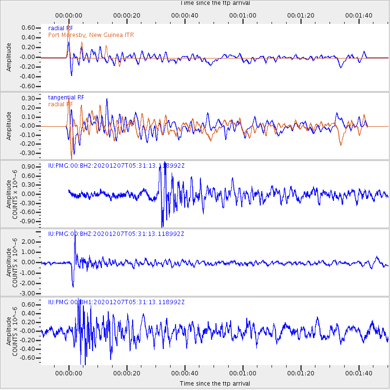
PMG Port Moresby, New Guinea - Earthquake Result Viewer
*The percent match for this event was below the threshold and hence no stack was calculated.
| Earthquake location: |
Fiji Islands Region |
| Earthquake latitude/longitude: |
-21.0/-179.2 |
| Earthquake time(UTC): |
2020/12/07 (342) 05:25:44 GMT |
| Earthquake Depth: |
598 km |
| Earthquake Magnitude: |
5.6 Mwb |
| Earthquake Catalog/Contributor: |
NEIC PDE/us |
|
| Network: |
IU Global Seismograph Network (GSN - IRIS/USGS) |
| Station: |
PMG Port Moresby, New Guinea |
| Lat/Lon: |
9.40 S/147.16 E |
| Elevation: |
90 m |
|
| Distance: |
34.4 deg |
| Az: |
284.48 deg |
| Baz: |
113.558 deg |
| Ray Param: |
$rayparam |
*The percent match for this event was below the threshold and hence was not used in the summary stack. |
|
| Radial Match: |
70.65516 % |
| Radial Bump: |
400 |
| Transverse Match: |
69.43897 % |
| Transverse Bump: |
400 |
| SOD ConfigId: |
23341671 |
| Insert Time: |
2020-12-27 14:35:46.459 +0000 |
| GWidth: |
2.5 |
| Max Bumps: |
400 |
| Tol: |
0.001 |
|
Signal To Noise
| Channel | StoN | STA | LTA |
| IU:PMG:00:BHZ:20201207T05:31:13.118992Z | 8.286292 | 9.614008E-7 | 1.16023045E-7 |
| IU:PMG:00:BH1:20201207T05:31:13.118992Z | 2.9688957 | 2.4545247E-7 | 8.267467E-8 |
| IU:PMG:00:BH2:20201207T05:31:13.118992Z | 8.141808 | 5.529829E-7 | 6.791893E-8 |
| Arrivals |
| Ps | |
| PpPs | |
| PsPs/PpSs | |


