You are here: Home > Network List > UW - Pacific Northwest Regional Seismic Network Stations List
> Station IRON Crane, OR, USA > Earthquake Result Viewer
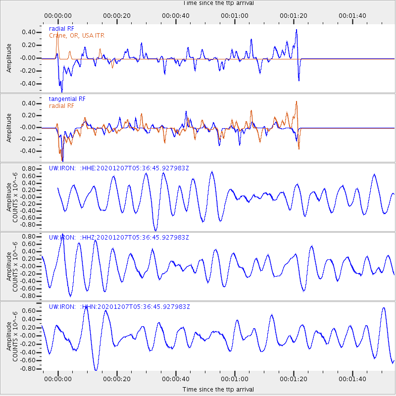
IRON Crane, OR, USA - Earthquake Result Viewer
*The percent match for this event was below the threshold and hence no stack was calculated.
| Earthquake location: |
Fiji Islands Region |
| Earthquake latitude/longitude: |
-21.0/-179.2 |
| Earthquake time(UTC): |
2020/12/07 (342) 05:25:44 GMT |
| Earthquake Depth: |
598 km |
| Earthquake Magnitude: |
5.6 Mwb |
| Earthquake Catalog/Contributor: |
NEIC PDE/us |
|
| Network: |
UW Pacific Northwest Regional Seismic Network |
| Station: |
IRON Crane, OR, USA |
| Lat/Lon: |
43.36 N/118.47 W |
| Elevation: |
1226 m |
|
| Distance: |
84.9 deg |
| Az: |
39.681 deg |
| Baz: |
234.865 deg |
| Ray Param: |
$rayparam |
*The percent match for this event was below the threshold and hence was not used in the summary stack. |
|
| Radial Match: |
37.4714 % |
| Radial Bump: |
400 |
| Transverse Match: |
44.767 % |
| Transverse Bump: |
232 |
| SOD ConfigId: |
23341671 |
| Insert Time: |
2020-12-27 14:41:06.961 +0000 |
| GWidth: |
2.5 |
| Max Bumps: |
400 |
| Tol: |
0.001 |
|
Signal To Noise
| Channel | StoN | STA | LTA |
| UW:IRON: :HHZ:20201207T05:36:45.927983Z | 3.131803 | 5.385981E-7 | 1.71977E-7 |
| UW:IRON: :HHN:20201207T05:36:45.927983Z | 0.40742177 | 1.567036E-7 | 3.8462258E-7 |
| UW:IRON: :HHE:20201207T05:36:45.927983Z | 2.1493297 | 5.975406E-7 | 2.7801252E-7 |
| Arrivals |
| Ps | |
| PpPs | |
| PsPs/PpSs | |


