You are here: Home > Network List > AZ - ANZA Regional Network Stations List
> Station LVA2 AZ.LVA2 > Earthquake Result Viewer
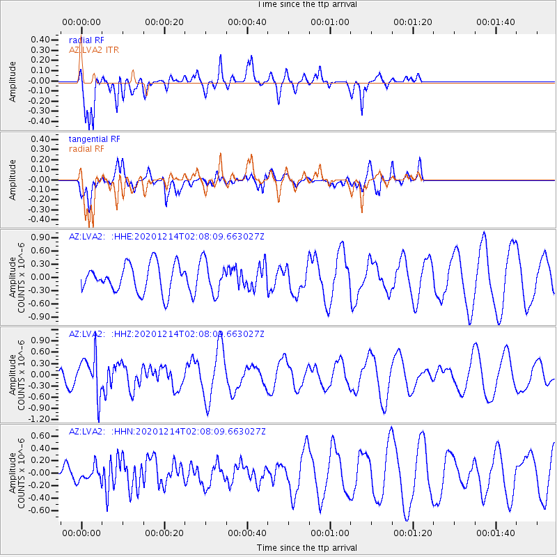
LVA2 AZ.LVA2 - Earthquake Result Viewer
*The percent match for this event was below the threshold and hence no stack was calculated.
| Earthquake location: |
South Of Fiji Islands |
| Earthquake latitude/longitude: |
-23.9/179.9 |
| Earthquake time(UTC): |
2020/12/14 (349) 01:57:10 GMT |
| Earthquake Depth: |
530 km |
| Earthquake Magnitude: |
5.6 mww |
| Earthquake Catalog/Contributor: |
NEIC PDE/us |
|
| Network: |
AZ ANZA Regional Network |
| Station: |
LVA2 AZ.LVA2 |
| Lat/Lon: |
33.35 N/116.56 W |
| Elevation: |
1435 m |
|
| Distance: |
83.1 deg |
| Az: |
49.025 deg |
| Baz: |
235.637 deg |
| Ray Param: |
$rayparam |
*The percent match for this event was below the threshold and hence was not used in the summary stack. |
|
| Radial Match: |
79.671684 % |
| Radial Bump: |
400 |
| Transverse Match: |
44.22937 % |
| Transverse Bump: |
400 |
| SOD ConfigId: |
23341671 |
| Insert Time: |
2020-12-28 03:02:36.834 +0000 |
| GWidth: |
2.5 |
| Max Bumps: |
400 |
| Tol: |
0.001 |
|
Signal To Noise
| Channel | StoN | STA | LTA |
| AZ:LVA2: :HHZ:20201214T02:08:09.663027Z | 2.7031944 | 5.2855717E-7 | 1.9553057E-7 |
| AZ:LVA2: :HHN:20201214T02:08:09.663027Z | 0.47531036 | 1.12806084E-7 | 2.3733142E-7 |
| AZ:LVA2: :HHE:20201214T02:08:09.663027Z | 1.1852363 | 3.7294362E-7 | 3.146576E-7 |
| Arrivals |
| Ps | |
| PpPs | |
| PsPs/PpSs | |


