You are here: Home > Network List > CI - Caltech Regional Seismic Network Stations List
> Station DAN Danby, California, USA > Earthquake Result Viewer
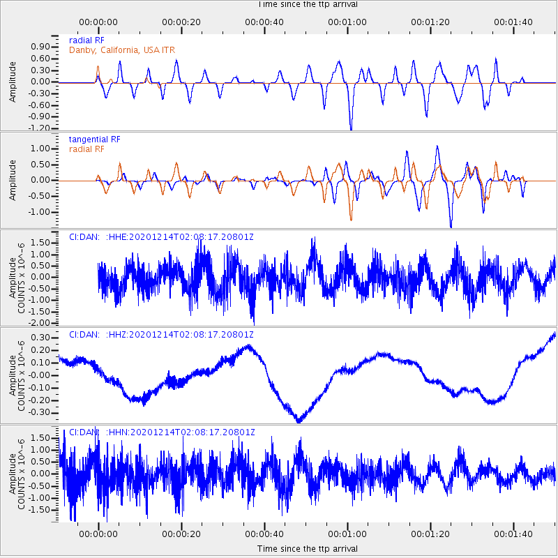
DAN Danby, California, USA - Earthquake Result Viewer
*The percent match for this event was below the threshold and hence no stack was calculated.
| Earthquake location: |
South Of Fiji Islands |
| Earthquake latitude/longitude: |
-23.9/179.9 |
| Earthquake time(UTC): |
2020/12/14 (349) 01:57:10 GMT |
| Earthquake Depth: |
530 km |
| Earthquake Magnitude: |
5.6 mww |
| Earthquake Catalog/Contributor: |
NEIC PDE/us |
|
| Network: |
CI Caltech Regional Seismic Network |
| Station: |
DAN Danby, California, USA |
| Lat/Lon: |
34.64 N/115.38 W |
| Elevation: |
398 m |
|
| Distance: |
84.6 deg |
| Az: |
48.51 deg |
| Baz: |
236.239 deg |
| Ray Param: |
$rayparam |
*The percent match for this event was below the threshold and hence was not used in the summary stack. |
|
| Radial Match: |
29.399977 % |
| Radial Bump: |
400 |
| Transverse Match: |
56.2921 % |
| Transverse Bump: |
400 |
| SOD ConfigId: |
23341671 |
| Insert Time: |
2020-12-28 03:04:28.557 +0000 |
| GWidth: |
2.5 |
| Max Bumps: |
400 |
| Tol: |
0.001 |
|
Signal To Noise
| Channel | StoN | STA | LTA |
| CI:DAN: :HHZ:20201214T02:08:17.20801Z | 2.027164 | 1.633957E-7 | 8.0603094E-8 |
| CI:DAN: :HHN:20201214T02:08:17.20801Z | 1.1942899 | 7.678275E-7 | 6.4291544E-7 |
| CI:DAN: :HHE:20201214T02:08:17.20801Z | 1.3363174 | 7.229841E-7 | 5.4102725E-7 |
| Arrivals |
| Ps | |
| PpPs | |
| PsPs/PpSs | |


