You are here: Home > Network List > US - United States National Seismic Network Stations List
> Station AMTX Amarillo, Texas, USA > Earthquake Result Viewer
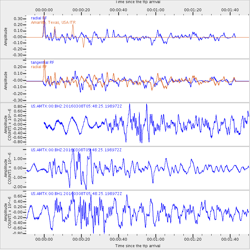
AMTX Amarillo, Texas, USA - Earthquake Result Viewer
*The percent match for this event was below the threshold and hence no stack was calculated.
| Earthquake location: |
Tonga Islands |
| Earthquake latitude/longitude: |
-15.1/-173.4 |
| Earthquake time(UTC): |
2016/03/08 (068) 05:36:27 GMT |
| Earthquake Depth: |
30 km |
| Earthquake Magnitude: |
5.8 MB |
| Earthquake Catalog/Contributor: |
NEIC PDE/NEIC COMCAT |
|
| Network: |
US United States National Seismic Network |
| Station: |
AMTX Amarillo, Texas, USA |
| Lat/Lon: |
34.53 N/101.41 W |
| Elevation: |
1010 m |
|
| Distance: |
84.3 deg |
| Az: |
52.107 deg |
| Baz: |
247.382 deg |
| Ray Param: |
$rayparam |
*The percent match for this event was below the threshold and hence was not used in the summary stack. |
|
| Radial Match: |
63.740562 % |
| Radial Bump: |
400 |
| Transverse Match: |
71.740746 % |
| Transverse Bump: |
400 |
| SOD ConfigId: |
2361031 |
| Insert Time: |
2017-10-09 15:13:27.009 +0000 |
| GWidth: |
2.5 |
| Max Bumps: |
400 |
| Tol: |
0.001 |
|
Signal To Noise
| Channel | StoN | STA | LTA |
| US:AMTX:00:BHZ:20160308T05:48:25.198972Z | 1.7555486 | 3.9386188E-7 | 2.2435259E-7 |
| US:AMTX:00:BH1:20160308T05:48:25.198972Z | 2.3658636 | 3.4366394E-7 | 1.4525942E-7 |
| US:AMTX:00:BH2:20160308T05:48:25.198972Z | 0.66397715 | 1.3745121E-7 | 2.0701195E-7 |
| Arrivals |
| Ps | |
| PpPs | |
| PsPs/PpSs | |


