You are here: Home > Network List > TA - USArray Transportable Network (new EarthScope stations) Stations List
> Station L15K Ungalak Mountain, AK, USA > Earthquake Result Viewer
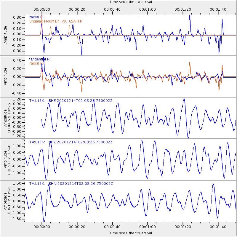
L15K Ungalak Mountain, AK, USA - Earthquake Result Viewer
*The percent match for this event was below the threshold and hence no stack was calculated.
| Earthquake location: |
South Of Fiji Islands |
| Earthquake latitude/longitude: |
-23.9/179.9 |
| Earthquake time(UTC): |
2020/12/14 (349) 01:57:10 GMT |
| Earthquake Depth: |
530 km |
| Earthquake Magnitude: |
5.6 mww |
| Earthquake Catalog/Contributor: |
NEIC PDE/us |
|
| Network: |
TA USArray Transportable Network (new EarthScope stations) |
| Station: |
L15K Ungalak Mountain, AK, USA |
| Lat/Lon: |
61.68 N/161.49 W |
| Elevation: |
219 m |
|
| Distance: |
86.6 deg |
| Az: |
8.785 deg |
| Baz: |
197.041 deg |
| Ray Param: |
$rayparam |
*The percent match for this event was below the threshold and hence was not used in the summary stack. |
|
| Radial Match: |
59.617985 % |
| Radial Bump: |
400 |
| Transverse Match: |
51.08458 % |
| Transverse Bump: |
309 |
| SOD ConfigId: |
23341671 |
| Insert Time: |
2020-12-28 03:09:36.278 +0000 |
| GWidth: |
2.5 |
| Max Bumps: |
400 |
| Tol: |
0.001 |
|
Signal To Noise
| Channel | StoN | STA | LTA |
| TA:L15K: :BHZ:20201214T02:08:26.750002Z | 2.4198852 | 9.335856E-7 | 3.8579748E-7 |
| TA:L15K: :BHN:20201214T02:08:26.750002Z | 1.9074118 | 1.0480513E-6 | 5.494625E-7 |
| TA:L15K: :BHE:20201214T02:08:26.750002Z | 1.3097166 | 6.597948E-7 | 5.037692E-7 |
| Arrivals |
| Ps | |
| PpPs | |
| PsPs/PpSs | |


