You are here: Home > Network List > CI - Caltech Regional Seismic Network Stations List
> Station SWS Sam W. Stewart, Westmorland, CA, USA > Earthquake Result Viewer
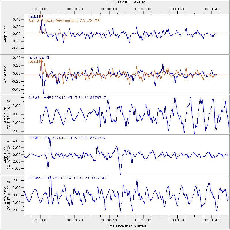
SWS Sam W. Stewart, Westmorland, CA, USA - Earthquake Result Viewer
*The percent match for this event was below the threshold and hence no stack was calculated.
| Earthquake location: |
Chile-Bolivia Border Region |
| Earthquake latitude/longitude: |
-21.8/-68.7 |
| Earthquake time(UTC): |
2020/12/14 (349) 15:20:49 GMT |
| Earthquake Depth: |
111 km |
| Earthquake Magnitude: |
6.0 Mww |
| Earthquake Catalog/Contributor: |
NEIC PDE/us |
|
| Network: |
CI Caltech Regional Seismic Network |
| Station: |
SWS Sam W. Stewart, Westmorland, CA, USA |
| Lat/Lon: |
32.94 N/115.80 W |
| Elevation: |
140 m |
|
| Distance: |
70.6 deg |
| Az: |
319.228 deg |
| Baz: |
133.807 deg |
| Ray Param: |
$rayparam |
*The percent match for this event was below the threshold and hence was not used in the summary stack. |
|
| Radial Match: |
68.441895 % |
| Radial Bump: |
346 |
| Transverse Match: |
78.211205 % |
| Transverse Bump: |
400 |
| SOD ConfigId: |
23341671 |
| Insert Time: |
2020-12-28 16:26:09.818 +0000 |
| GWidth: |
2.5 |
| Max Bumps: |
400 |
| Tol: |
0.001 |
|
Signal To Noise
| Channel | StoN | STA | LTA |
| CI:SWS: :HHZ:20201214T15:31:21.837974Z | 3.1751876 | 1.2193933E-6 | 3.840382E-7 |
| CI:SWS: :HHN:20201214T15:31:21.837974Z | 1.6576734 | 5.653087E-7 | 3.4102538E-7 |
| CI:SWS: :HHE:20201214T15:31:21.837974Z | 0.83516777 | 5.0320597E-7 | 6.0252086E-7 |
| Arrivals |
| Ps | |
| PpPs | |
| PsPs/PpSs | |


