You are here: Home > Network List > IU - Global Seismograph Network (GSN - IRIS/USGS) Stations List
> Station CTAO Charters Towers, Australia > Earthquake Result Viewer
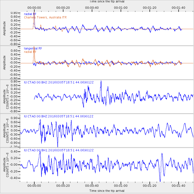
CTAO Charters Towers, Australia - Earthquake Result Viewer
*The percent match for this event was below the threshold and hence no stack was calculated.
| Earthquake location: |
South Of Kermadec Islands |
| Earthquake latitude/longitude: |
-32.9/-178.2 |
| Earthquake time(UTC): |
2016/03/05 (065) 18:45:30 GMT |
| Earthquake Depth: |
10 km |
| Earthquake Magnitude: |
5.5 MB |
| Earthquake Catalog/Contributor: |
NEIC PDE/NEIC COMCAT |
|
| Network: |
IU Global Seismograph Network (GSN - IRIS/USGS) |
| Station: |
CTAO Charters Towers, Australia |
| Lat/Lon: |
20.09 S/146.25 E |
| Elevation: |
357 m |
|
| Distance: |
34.1 deg |
| Az: |
283.031 deg |
| Baz: |
119.328 deg |
| Ray Param: |
$rayparam |
*The percent match for this event was below the threshold and hence was not used in the summary stack. |
|
| Radial Match: |
79.04194 % |
| Radial Bump: |
365 |
| Transverse Match: |
48.932957 % |
| Transverse Bump: |
400 |
| SOD ConfigId: |
2361031 |
| Insert Time: |
2017-10-09 15:18:31.994 +0000 |
| GWidth: |
2.5 |
| Max Bumps: |
400 |
| Tol: |
0.001 |
|
Signal To Noise
| Channel | StoN | STA | LTA |
| IU:CTAO:00:BHZ:20160305T18:51:44.069012Z | 2.2501373 | 2.7520858E-7 | 1.2230745E-7 |
| IU:CTAO:00:BH1:20160305T18:51:44.069012Z | 1.5219363 | 1.7368421E-7 | 1.1412055E-7 |
| IU:CTAO:00:BH2:20160305T18:51:44.069012Z | 2.0307832 | 1.7601207E-7 | 8.667201E-8 |
| Arrivals |
| Ps | |
| PpPs | |
| PsPs/PpSs | |


