You are here: Home > Network List > CN - Canadian National Seismograph Network Stations List
> Station INK INUVIK, NT > Earthquake Result Viewer
INK INUVIK, NT - Earthquake Result Viewer
*The percent match for this event was below the threshold and hence no stack was calculated.
| Earthquake location: |
Norwegian Sea |
| Earthquake latitude/longitude: |
72.2/0.8 |
| Earthquake time(UTC): |
2020/12/14 (349) 19:35:59 GMT |
| Earthquake Depth: |
10 km |
| Earthquake Magnitude: |
5.8 Mww |
| Earthquake Catalog/Contributor: |
NEIC PDE/us |
|
| Network: |
CN Canadian National Seismograph Network |
| Station: |
INK INUVIK, NT |
| Lat/Lon: |
68.31 N/133.53 W |
| Elevation: |
44 m |
|
| Distance: |
36.5 deg |
| Az: |
333.435 deg |
| Baz: |
21.68 deg |
| Ray Param: |
$rayparam |
*The percent match for this event was below the threshold and hence was not used in the summary stack. |
|
| Radial Match: |
67.01661 % |
| Radial Bump: |
400 |
| Transverse Match: |
56.171936 % |
| Transverse Bump: |
400 |
| SOD ConfigId: |
23341671 |
| Insert Time: |
2020-12-28 20:43:33.173 +0000 |
| GWidth: |
2.5 |
| Max Bumps: |
400 |
| Tol: |
0.001 |
|
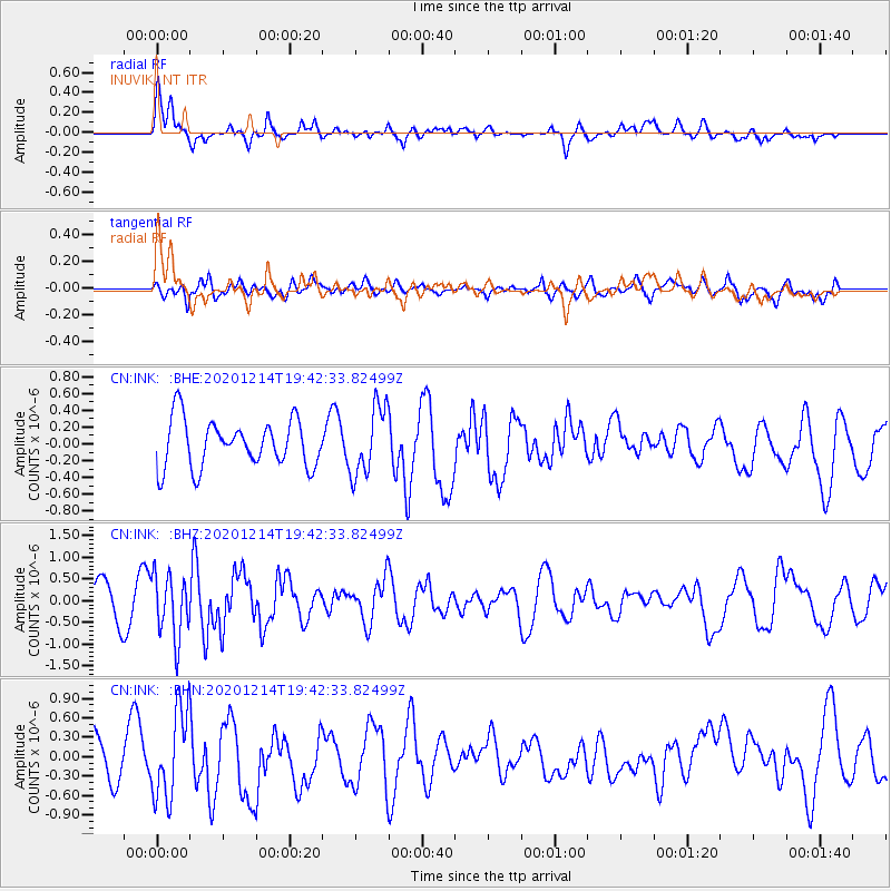
Signal To Noise
| Channel | StoN | STA | LTA |
| CN:INK: :BHZ:20201214T19:42:33.82499Z | 2.2861068 | 7.217107E-7 | 3.1569422E-7 |
| CN:INK: :BHN:20201214T19:42:33.82499Z | 2.5671964 | 6.8762324E-7 | 2.6784988E-7 |
| CN:INK: :BHE:20201214T19:42:33.82499Z | 1.4485729 | 4.0848542E-7 | 2.8199162E-7 |
| Arrivals |
| Ps | |
| PpPs | |
| PsPs/PpSs | |


