You are here: Home > Network List > NE - New England Seismic Network Stations List
> Station EMMW Machias, ME, USA > Earthquake Result Viewer
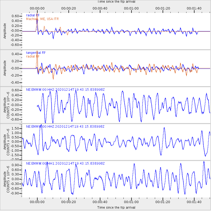
EMMW Machias, ME, USA - Earthquake Result Viewer
*The percent match for this event was below the threshold and hence no stack was calculated.
| Earthquake location: |
Norwegian Sea |
| Earthquake latitude/longitude: |
72.2/0.8 |
| Earthquake time(UTC): |
2020/12/14 (349) 19:35:59 GMT |
| Earthquake Depth: |
10 km |
| Earthquake Magnitude: |
5.8 Mww |
| Earthquake Catalog/Contributor: |
NEIC PDE/us |
|
| Network: |
NE New England Seismic Network |
| Station: |
EMMW Machias, ME, USA |
| Lat/Lon: |
44.71 N/67.46 W |
| Elevation: |
35 m |
|
| Distance: |
41.5 deg |
| Az: |
266.855 deg |
| Baz: |
25.471 deg |
| Ray Param: |
$rayparam |
*The percent match for this event was below the threshold and hence was not used in the summary stack. |
|
| Radial Match: |
62.33874 % |
| Radial Bump: |
400 |
| Transverse Match: |
43.248737 % |
| Transverse Bump: |
400 |
| SOD ConfigId: |
23341671 |
| Insert Time: |
2020-12-28 20:50:24.735 +0000 |
| GWidth: |
2.5 |
| Max Bumps: |
400 |
| Tol: |
0.001 |
|
Signal To Noise
| Channel | StoN | STA | LTA |
| NE:EMMW:00:HHZ:20201214T19:43:15.838998Z | 3.4502268 | 1.1384142E-6 | 3.2995345E-7 |
| NE:EMMW:00:HH1:20201214T19:43:15.838998Z | 1.2132254 | 4.2048416E-7 | 3.4658373E-7 |
| NE:EMMW:00:HH2:20201214T19:43:15.838998Z | 0.7609893 | 2.734704E-7 | 3.5936168E-7 |
| Arrivals |
| Ps | |
| PpPs | |
| PsPs/PpSs | |


