You are here: Home > Network List > GS - US Geological Survey Networks Stations List
> Station OK051 E0350 and S34600 Roads, Ralston, OK > Earthquake Result Viewer
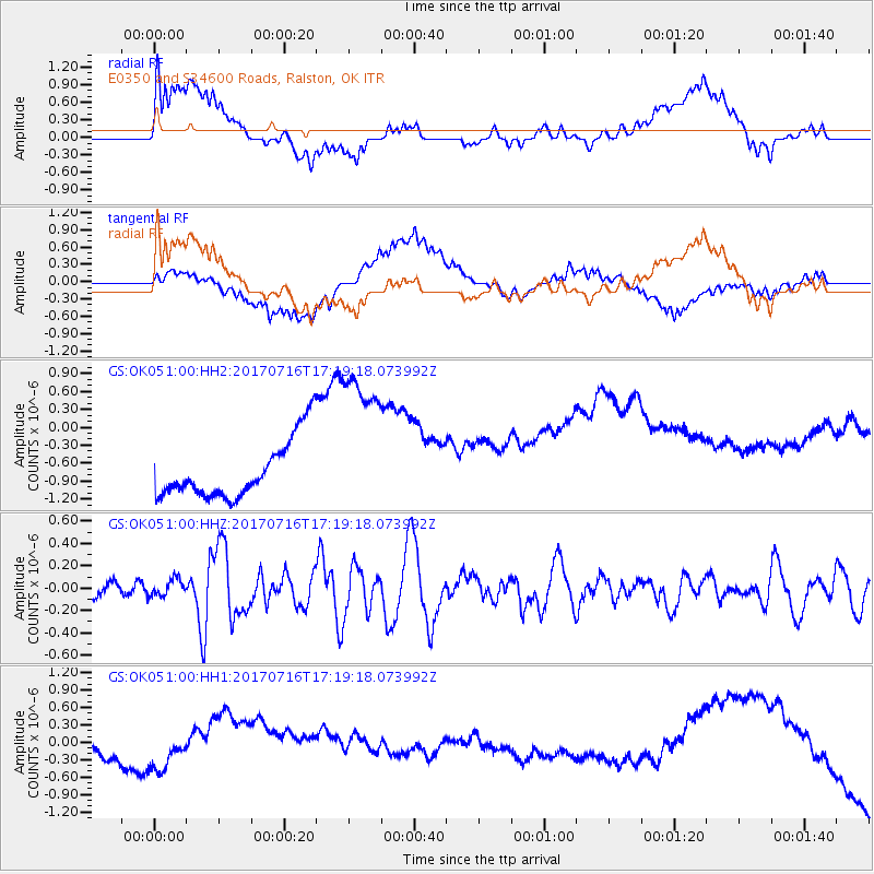
OK051 E0350 and S34600 Roads, Ralston, OK - Earthquake Result Viewer
*The percent match for this event was below the threshold and hence no stack was calculated.
| Earthquake location: |
Tonga Islands |
| Earthquake latitude/longitude: |
-20.4/-173.5 |
| Earthquake time(UTC): |
2017/07/16 (197) 17:06:41 GMT |
| Earthquake Depth: |
10 km |
| Earthquake Magnitude: |
5.5 Mww |
| Earthquake Catalog/Contributor: |
NEIC PDE/us |
|
| Network: |
GS US Geological Survey Networks |
| Station: |
OK051 E0350 and S34600 Roads, Ralston, OK |
| Lat/Lon: |
36.51 N/96.84 W |
| Elevation: |
263 m |
|
| Distance: |
91.8 deg |
| Az: |
51.647 deg |
| Baz: |
245.89 deg |
| Ray Param: |
$rayparam |
*The percent match for this event was below the threshold and hence was not used in the summary stack. |
|
| Radial Match: |
18.108444 % |
| Radial Bump: |
400 |
| Transverse Match: |
31.451998 % |
| Transverse Bump: |
400 |
| SOD ConfigId: |
2364251 |
| Insert Time: |
2017-10-09 15:57:10.067 +0000 |
| GWidth: |
2.5 |
| Max Bumps: |
400 |
| Tol: |
0.001 |
|
Signal To Noise
| Channel | StoN | STA | LTA |
| GS:OK051:00:HHZ:20170716T17:19:18.073992Z | 1.2494574 | 7.61884E-8 | 6.097719E-8 |
| GS:OK051:00:HH1:20170716T17:19:18.073992Z | 1.062549 | 2.1160281E-7 | 1.9914641E-7 |
| GS:OK051:00:HH2:20170716T17:19:18.073992Z | 3.0661309 | 1.4295947E-6 | 4.6625365E-7 |
| Arrivals |
| Ps | |
| PpPs | |
| PsPs/PpSs | |


