You are here: Home > Network List > TA - USArray Transportable Network (new EarthScope stations) Stations List
> Station I30M Mount Dempster, Yukon, CAN > Earthquake Result Viewer
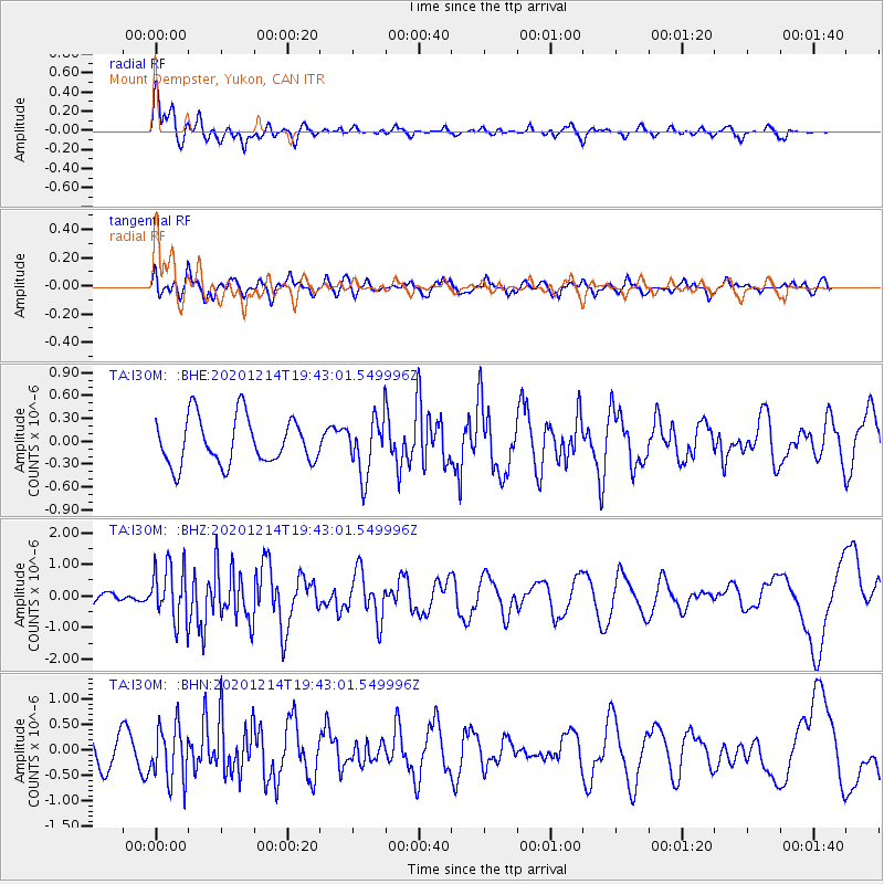
I30M Mount Dempster, Yukon, CAN - Earthquake Result Viewer
*The percent match for this event was below the threshold and hence no stack was calculated.
| Earthquake location: |
Norwegian Sea |
| Earthquake latitude/longitude: |
72.2/0.8 |
| Earthquake time(UTC): |
2020/12/14 (349) 19:35:59 GMT |
| Earthquake Depth: |
10 km |
| Earthquake Magnitude: |
5.8 Mww |
| Earthquake Catalog/Contributor: |
NEIC PDE/us |
|
| Network: |
TA USArray Transportable Network (new EarthScope stations) |
| Station: |
I30M Mount Dempster, Yukon, CAN |
| Lat/Lon: |
65.22 N/136.38 W |
| Elevation: |
1399 m |
|
| Distance: |
39.8 deg |
| Az: |
333.407 deg |
| Baz: |
19.04 deg |
| Ray Param: |
$rayparam |
*The percent match for this event was below the threshold and hence was not used in the summary stack. |
|
| Radial Match: |
77.30277 % |
| Radial Bump: |
400 |
| Transverse Match: |
60.157185 % |
| Transverse Bump: |
400 |
| SOD ConfigId: |
23341671 |
| Insert Time: |
2020-12-28 20:55:47.737 +0000 |
| GWidth: |
2.5 |
| Max Bumps: |
400 |
| Tol: |
0.001 |
|
Signal To Noise
| Channel | StoN | STA | LTA |
| TA:I30M: :BHZ:20201214T19:43:01.549996Z | 3.038842 | 8.7342977E-7 | 2.874219E-7 |
| TA:I30M: :BHN:20201214T19:43:01.549996Z | 1.3681446 | 5.4152724E-7 | 3.9581138E-7 |
| TA:I30M: :BHE:20201214T19:43:01.549996Z | 1.2062663 | 3.6864154E-7 | 3.0560545E-7 |
| Arrivals |
| Ps | |
| PpPs | |
| PsPs/PpSs | |


