You are here: Home > Network List > US - United States National Seismic Network Stations List
> Station MSO Missoula, Montana, USA > Earthquake Result Viewer
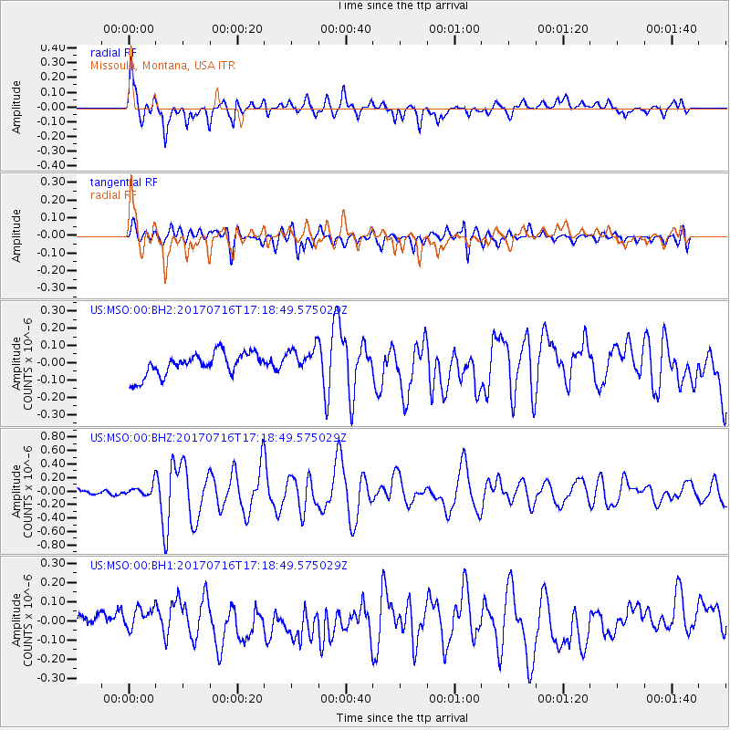
MSO Missoula, Montana, USA - Earthquake Result Viewer
*The percent match for this event was below the threshold and hence no stack was calculated.
| Earthquake location: |
Tonga Islands |
| Earthquake latitude/longitude: |
-20.4/-173.5 |
| Earthquake time(UTC): |
2017/07/16 (197) 17:06:41 GMT |
| Earthquake Depth: |
10 km |
| Earthquake Magnitude: |
5.5 Mww |
| Earthquake Catalog/Contributor: |
NEIC PDE/us |
|
| Network: |
US United States National Seismic Network |
| Station: |
MSO Missoula, Montana, USA |
| Lat/Lon: |
46.83 N/113.94 W |
| Elevation: |
1264 m |
|
| Distance: |
85.7 deg |
| Az: |
36.393 deg |
| Baz: |
234.133 deg |
| Ray Param: |
$rayparam |
*The percent match for this event was below the threshold and hence was not used in the summary stack. |
|
| Radial Match: |
66.40137 % |
| Radial Bump: |
400 |
| Transverse Match: |
78.27514 % |
| Transverse Bump: |
400 |
| SOD ConfigId: |
2364251 |
| Insert Time: |
2017-10-09 15:58:39.139 +0000 |
| GWidth: |
2.5 |
| Max Bumps: |
400 |
| Tol: |
0.001 |
|
Signal To Noise
| Channel | StoN | STA | LTA |
| US:MSO:00:BHZ:20170716T17:18:49.575029Z | 2.4508662 | 9.134643E-8 | 3.727108E-8 |
| US:MSO:00:BH1:20170716T17:18:49.575029Z | 1.0539479 | 6.413555E-8 | 6.085268E-8 |
| US:MSO:00:BH2:20170716T17:18:49.575029Z | 0.98372763 | 6.578858E-8 | 6.687683E-8 |
| Arrivals |
| Ps | |
| PpPs | |
| PsPs/PpSs | |


