You are here: Home > Network List > TX - Texas Seismological Network Stations List
> Station WTFS Witchita Falls > Earthquake Result Viewer
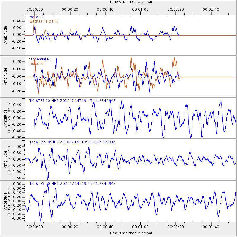
WTFS Witchita Falls - Earthquake Result Viewer
*The percent match for this event was below the threshold and hence no stack was calculated.
| Earthquake location: |
Norwegian Sea |
| Earthquake latitude/longitude: |
72.2/0.8 |
| Earthquake time(UTC): |
2020/12/14 (349) 19:35:59 GMT |
| Earthquake Depth: |
10 km |
| Earthquake Magnitude: |
5.8 Mww |
| Earthquake Catalog/Contributor: |
NEIC PDE/us |
|
| Network: |
TX Texas Seismological Network |
| Station: |
WTFS Witchita Falls |
| Lat/Lon: |
33.77 N/98.46 W |
| Elevation: |
277 m |
|
| Distance: |
61.0 deg |
| Az: |
289.869 deg |
| Baz: |
20.287 deg |
| Ray Param: |
$rayparam |
*The percent match for this event was below the threshold and hence was not used in the summary stack. |
|
| Radial Match: |
62.8648 % |
| Radial Bump: |
400 |
| Transverse Match: |
53.857998 % |
| Transverse Bump: |
343 |
| SOD ConfigId: |
23341671 |
| Insert Time: |
2020-12-28 20:57:35.235 +0000 |
| GWidth: |
2.5 |
| Max Bumps: |
400 |
| Tol: |
0.001 |
|
Signal To Noise
| Channel | StoN | STA | LTA |
| TX:WTFS:00:HHZ:20201214T19:45:41.234994Z | 1.7463675 | 4.6540882E-7 | 2.6650108E-7 |
| TX:WTFS:00:HH1:20201214T19:45:41.234994Z | 2.1611578 | 4.125892E-7 | 1.9091118E-7 |
| TX:WTFS:00:HH2:20201214T19:45:41.234994Z | 1.5379745 | 2.8707623E-7 | 1.8665865E-7 |
| Arrivals |
| Ps | |
| PpPs | |
| PsPs/PpSs | |


