You are here: Home > Network List > US - United States National Seismic Network Stations List
> Station CBKS Cedar Bluff, Kansas, USA > Earthquake Result Viewer
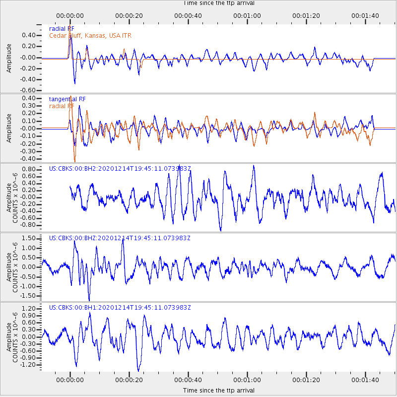
CBKS Cedar Bluff, Kansas, USA - Earthquake Result Viewer
*The percent match for this event was below the threshold and hence no stack was calculated.
| Earthquake location: |
Norwegian Sea |
| Earthquake latitude/longitude: |
72.2/0.8 |
| Earthquake time(UTC): |
2020/12/14 (349) 19:35:59 GMT |
| Earthquake Depth: |
10 km |
| Earthquake Magnitude: |
5.8 Mww |
| Earthquake Catalog/Contributor: |
NEIC PDE/us |
|
| Network: |
US United States National Seismic Network |
| Station: |
CBKS Cedar Bluff, Kansas, USA |
| Lat/Lon: |
38.81 N/99.74 W |
| Elevation: |
677 m |
|
| Distance: |
56.6 deg |
| Az: |
293.079 deg |
| Baz: |
21.202 deg |
| Ray Param: |
$rayparam |
*The percent match for this event was below the threshold and hence was not used in the summary stack. |
|
| Radial Match: |
62.77922 % |
| Radial Bump: |
400 |
| Transverse Match: |
63.535164 % |
| Transverse Bump: |
400 |
| SOD ConfigId: |
23341671 |
| Insert Time: |
2020-12-28 20:58:04.474 +0000 |
| GWidth: |
2.5 |
| Max Bumps: |
400 |
| Tol: |
0.001 |
|
Signal To Noise
| Channel | StoN | STA | LTA |
| US:CBKS:00:BHZ:20201214T19:45:11.073983Z | 2.7779078 | 6.7106663E-7 | 2.4157268E-7 |
| US:CBKS:00:BH1:20201214T19:45:11.073983Z | 2.50456 | 5.0272985E-7 | 2.0072581E-7 |
| US:CBKS:00:BH2:20201214T19:45:11.073983Z | 2.0136137 | 3.8637302E-7 | 1.918804E-7 |
| Arrivals |
| Ps | |
| PpPs | |
| PsPs/PpSs | |


