You are here: Home > Network List > TA - USArray Transportable Network (new EarthScope stations) Stations List
> Station I17K Unalakleet, AK, USA > Earthquake Result Viewer
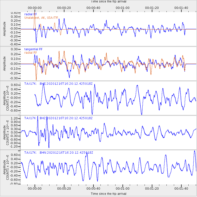
I17K Unalakleet, AK, USA - Earthquake Result Viewer
*The percent match for this event was below the threshold and hence no stack was calculated.
| Earthquake location: |
New Guinea, Papua New Guinea |
| Earthquake latitude/longitude: |
-6.4/143.2 |
| Earthquake time(UTC): |
2020/12/16 (351) 16:08:26 GMT |
| Earthquake Depth: |
14 km |
| Earthquake Magnitude: |
5.2 Mww |
| Earthquake Catalog/Contributor: |
NEIC PDE/us |
|
| Network: |
TA USArray Transportable Network (new EarthScope stations) |
| Station: |
I17K Unalakleet, AK, USA |
| Lat/Lon: |
63.89 N/160.70 W |
| Elevation: |
105 m |
|
| Distance: |
81.6 deg |
| Az: |
21.808 deg |
| Baz: |
236.547 deg |
| Ray Param: |
$rayparam |
*The percent match for this event was below the threshold and hence was not used in the summary stack. |
|
| Radial Match: |
49.36838 % |
| Radial Bump: |
400 |
| Transverse Match: |
53.002087 % |
| Transverse Bump: |
400 |
| SOD ConfigId: |
23341671 |
| Insert Time: |
2020-12-30 17:16:11.394 +0000 |
| GWidth: |
2.5 |
| Max Bumps: |
400 |
| Tol: |
0.001 |
|
Signal To Noise
| Channel | StoN | STA | LTA |
| TA:I17K: :BHZ:20201216T16:20:12.425018Z | 2.601594 | 5.3403994E-7 | 2.0527412E-7 |
| TA:I17K: :BHN:20201216T16:20:12.425018Z | 1.4741759 | 2.4513773E-7 | 1.6628796E-7 |
| TA:I17K: :BHE:20201216T16:20:12.425018Z | 0.93047416 | 2.2536169E-7 | 2.422009E-7 |
| Arrivals |
| Ps | |
| PpPs | |
| PsPs/PpSs | |


