You are here: Home > Network List > CI - Caltech Regional Seismic Network Stations List
> Station DGR Domenigoni Reservoir, California, USA > Earthquake Result Viewer
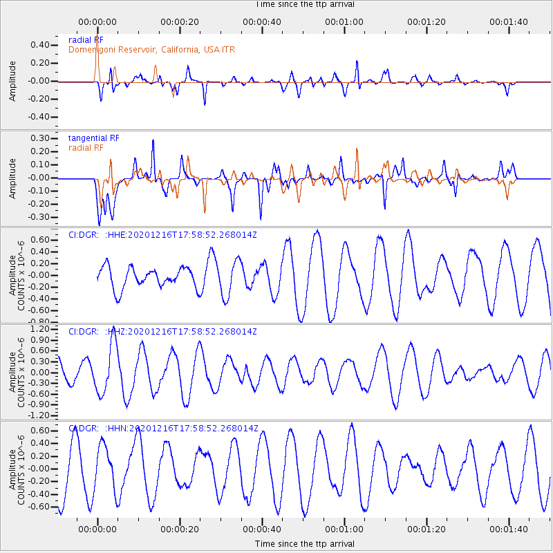
DGR Domenigoni Reservoir, California, USA - Earthquake Result Viewer
*The percent match for this event was below the threshold and hence no stack was calculated.
| Earthquake location: |
Southern Peru |
| Earthquake latitude/longitude: |
-16.6/-71.4 |
| Earthquake time(UTC): |
2020/12/16 (351) 17:48:44 GMT |
| Earthquake Depth: |
87 km |
| Earthquake Magnitude: |
5.6 mww |
| Earthquake Catalog/Contributor: |
NEIC PDE/us |
|
| Network: |
CI Caltech Regional Seismic Network |
| Station: |
DGR Domenigoni Reservoir, California, USA |
| Lat/Lon: |
33.65 N/117.01 W |
| Elevation: |
609 m |
|
| Distance: |
66.2 deg |
| Az: |
319.368 deg |
| Baz: |
131.522 deg |
| Ray Param: |
$rayparam |
*The percent match for this event was below the threshold and hence was not used in the summary stack. |
|
| Radial Match: |
45.483383 % |
| Radial Bump: |
366 |
| Transverse Match: |
74.76946 % |
| Transverse Bump: |
400 |
| SOD ConfigId: |
23341671 |
| Insert Time: |
2020-12-30 18:52:35.266 +0000 |
| GWidth: |
2.5 |
| Max Bumps: |
400 |
| Tol: |
0.001 |
|
Signal To Noise
| Channel | StoN | STA | LTA |
| CI:DGR: :HHZ:20201216T17:58:52.268014Z | 2.2705271 | 7.1801554E-7 | 3.1623296E-7 |
| CI:DGR: :HHN:20201216T17:58:52.268014Z | 1.0696337 | 3.5351295E-7 | 3.3049906E-7 |
| CI:DGR: :HHE:20201216T17:58:52.268014Z | 1.7651966 | 3.018732E-7 | 1.7101394E-7 |
| Arrivals |
| Ps | |
| PpPs | |
| PsPs/PpSs | |


