You are here: Home > Network List > US - United States National Seismic Network Stations List
> Station ELK Elko, Nevada, USA > Earthquake Result Viewer
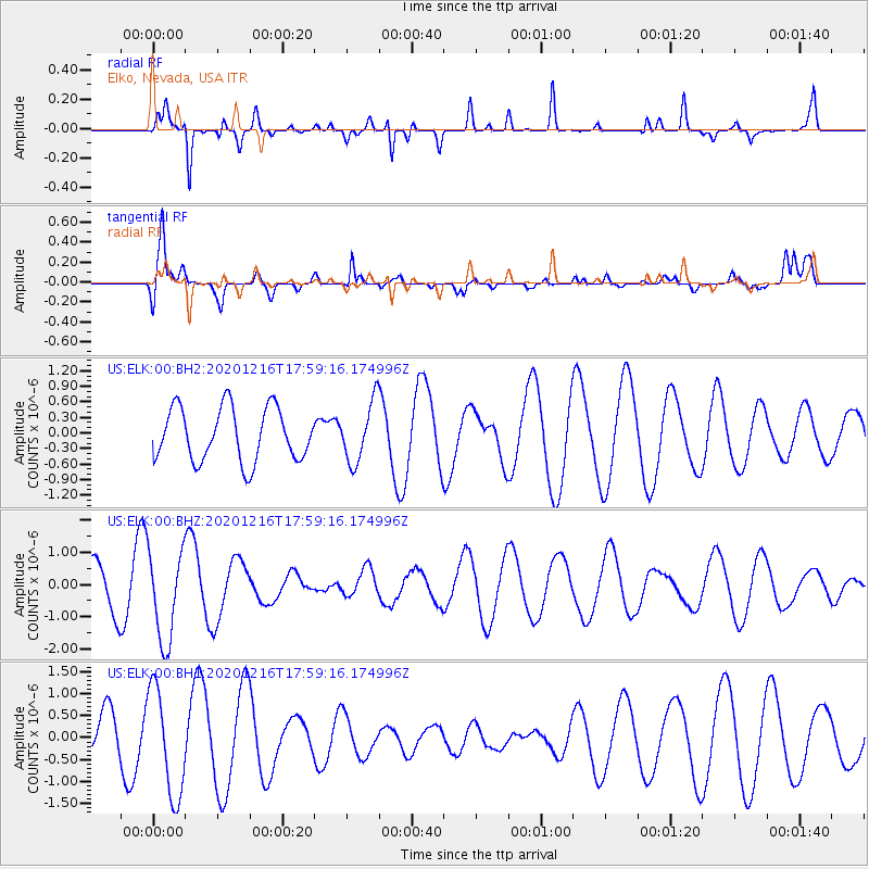
ELK Elko, Nevada, USA - Earthquake Result Viewer
*The percent match for this event was below the threshold and hence no stack was calculated.
| Earthquake location: |
Southern Peru |
| Earthquake latitude/longitude: |
-16.6/-71.4 |
| Earthquake time(UTC): |
2020/12/16 (351) 17:48:44 GMT |
| Earthquake Depth: |
87 km |
| Earthquake Magnitude: |
5.6 mww |
| Earthquake Catalog/Contributor: |
NEIC PDE/us |
|
| Network: |
US United States National Seismic Network |
| Station: |
ELK Elko, Nevada, USA |
| Lat/Lon: |
40.74 N/115.24 W |
| Elevation: |
2210 m |
|
| Distance: |
70.0 deg |
| Az: |
325.968 deg |
| Baz: |
135.055 deg |
| Ray Param: |
$rayparam |
*The percent match for this event was below the threshold and hence was not used in the summary stack. |
|
| Radial Match: |
80.83584 % |
| Radial Bump: |
285 |
| Transverse Match: |
69.83169 % |
| Transverse Bump: |
400 |
| SOD ConfigId: |
23341671 |
| Insert Time: |
2020-12-30 19:04:39.848 +0000 |
| GWidth: |
2.5 |
| Max Bumps: |
400 |
| Tol: |
0.001 |
|
Signal To Noise
| Channel | StoN | STA | LTA |
| US:ELK:00:BHZ:20201216T17:59:16.174996Z | 2.8334973 | 1.4088304E-6 | 4.9720546E-7 |
| US:ELK:00:BH1:20201216T17:59:16.174996Z | 3.0385382 | 1.228485E-6 | 4.043013E-7 |
| US:ELK:00:BH2:20201216T17:59:16.174996Z | 1.1199841 | 5.745215E-7 | 5.129729E-7 |
| Arrivals |
| Ps | |
| PpPs | |
| PsPs/PpSs | |


