You are here: Home > Network List > CI - Caltech Regional Seismic Network Stations List
> Station BAR Barrett, Tecate, CA, USA > Earthquake Result Viewer
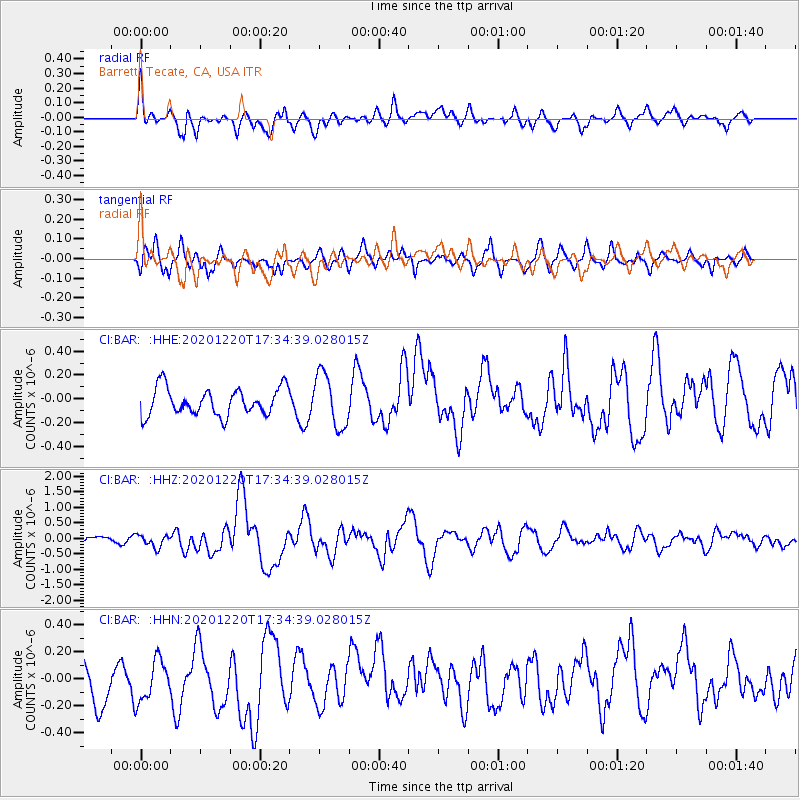
BAR Barrett, Tecate, CA, USA - Earthquake Result Viewer
*The percent match for this event was below the threshold and hence no stack was calculated.
| Earthquake location: |
Near East Coast Of Honshu, Japan |
| Earthquake latitude/longitude: |
40.8/142.5 |
| Earthquake time(UTC): |
2020/12/20 (355) 17:23:19 GMT |
| Earthquake Depth: |
10 km |
| Earthquake Magnitude: |
6.2 mww |
| Earthquake Catalog/Contributor: |
NEIC PDE/us |
|
| Network: |
CI Caltech Regional Seismic Network |
| Station: |
BAR Barrett, Tecate, CA, USA |
| Lat/Lon: |
32.68 N/116.67 W |
| Elevation: |
521 m |
|
| Distance: |
76.7 deg |
| Az: |
58.355 deg |
| Baz: |
310.01 deg |
| Ray Param: |
$rayparam |
*The percent match for this event was below the threshold and hence was not used in the summary stack. |
|
| Radial Match: |
55.08614 % |
| Radial Bump: |
400 |
| Transverse Match: |
58.129936 % |
| Transverse Bump: |
400 |
| SOD ConfigId: |
23341671 |
| Insert Time: |
2021-01-03 18:32:43.320 +0000 |
| GWidth: |
2.5 |
| Max Bumps: |
400 |
| Tol: |
0.001 |
|
Signal To Noise
| Channel | StoN | STA | LTA |
| CI:BAR: :HHZ:20201220T17:34:39.028015Z | 1.3379183 | 1.9509224E-7 | 1.4581775E-7 |
| CI:BAR: :HHN:20201220T17:34:39.028015Z | 1.1799951 | 1.6223582E-7 | 1.3748854E-7 |
| CI:BAR: :HHE:20201220T17:34:39.028015Z | 1.9777989 | 2.264662E-7 | 1.14504154E-7 |
| Arrivals |
| Ps | |
| PpPs | |
| PsPs/PpSs | |


