You are here: Home > Network List > CN - Canadian National Seismograph Network Stations List
> Station FRB IQALUIT, N.W.T. > Earthquake Result Viewer
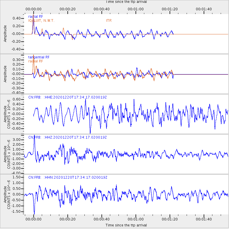
FRB IQALUIT, N.W.T. - Earthquake Result Viewer
*The percent match for this event was below the threshold and hence no stack was calculated.
| Earthquake location: |
Near East Coast Of Honshu, Japan |
| Earthquake latitude/longitude: |
40.8/142.5 |
| Earthquake time(UTC): |
2020/12/20 (355) 17:23:19 GMT |
| Earthquake Depth: |
10 km |
| Earthquake Magnitude: |
6.2 mww |
| Earthquake Catalog/Contributor: |
NEIC PDE/us |
|
| Network: |
CN Canadian National Seismograph Network |
| Station: |
FRB IQALUIT, N.W.T. |
| Lat/Lon: |
63.75 N/68.55 W |
| Elevation: |
18 m |
|
| Distance: |
72.9 deg |
| Az: |
13.903 deg |
| Baz: |
335.799 deg |
| Ray Param: |
$rayparam |
*The percent match for this event was below the threshold and hence was not used in the summary stack. |
|
| Radial Match: |
70.58202 % |
| Radial Bump: |
369 |
| Transverse Match: |
46.69444 % |
| Transverse Bump: |
400 |
| SOD ConfigId: |
23341671 |
| Insert Time: |
2021-01-03 18:34:19.926 +0000 |
| GWidth: |
2.5 |
| Max Bumps: |
400 |
| Tol: |
0.001 |
|
Signal To Noise
| Channel | StoN | STA | LTA |
| CN:FRB: :HHZ:20201220T17:34:17.020019Z | 3.4460359 | 1.3784922E-6 | 4.0002263E-7 |
| CN:FRB: :HHN:20201220T17:34:17.020019Z | 1.9753339 | 6.024883E-7 | 3.0500578E-7 |
| CN:FRB: :HHE:20201220T17:34:17.020019Z | 1.4126956 | 3.1511124E-7 | 2.2305672E-7 |
| Arrivals |
| Ps | |
| PpPs | |
| PsPs/PpSs | |


