You are here: Home > Network List > CN - Canadian National Seismograph Network Stations List
> Station INK INUVIK, NT > Earthquake Result Viewer
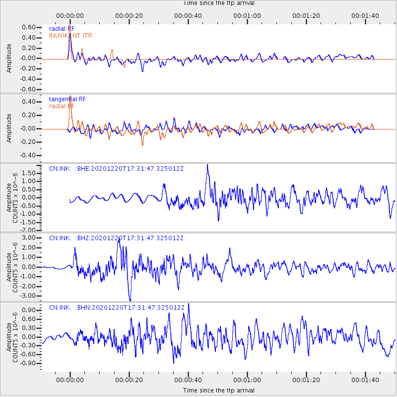
INK INUVIK, NT - Earthquake Result Viewer
*The percent match for this event was below the threshold and hence no stack was calculated.
| Earthquake location: |
Near East Coast Of Honshu, Japan |
| Earthquake latitude/longitude: |
40.8/142.5 |
| Earthquake time(UTC): |
2020/12/20 (355) 17:23:19 GMT |
| Earthquake Depth: |
10 km |
| Earthquake Magnitude: |
6.2 mww |
| Earthquake Catalog/Contributor: |
NEIC PDE/us |
|
| Network: |
CN Canadian National Seismograph Network |
| Station: |
INK INUVIK, NT |
| Lat/Lon: |
68.31 N/133.53 W |
| Elevation: |
44 m |
|
| Distance: |
50.6 deg |
| Az: |
28.576 deg |
| Baz: |
282.535 deg |
| Ray Param: |
$rayparam |
*The percent match for this event was below the threshold and hence was not used in the summary stack. |
|
| Radial Match: |
76.64387 % |
| Radial Bump: |
400 |
| Transverse Match: |
61.57405 % |
| Transverse Bump: |
400 |
| SOD ConfigId: |
23341671 |
| Insert Time: |
2021-01-03 18:34:32.918 +0000 |
| GWidth: |
2.5 |
| Max Bumps: |
400 |
| Tol: |
0.001 |
|
Signal To Noise
| Channel | StoN | STA | LTA |
| CN:INK: :BHZ:20201220T17:31:47.325012Z | 3.3902354 | 6.6351606E-7 | 1.9571387E-7 |
| CN:INK: :BHN:20201220T17:31:47.325012Z | 0.9783746 | 1.3716584E-7 | 1.4019767E-7 |
| CN:INK: :BHE:20201220T17:31:47.325012Z | 2.3139594 | 3.8296324E-7 | 1.6550128E-7 |
| Arrivals |
| Ps | |
| PpPs | |
| PsPs/PpSs | |


