You are here: Home > Network List > IC - New China Digital Seismograph Network Stations List
> Station KMI Kunming, Yunnan Province, China > Earthquake Result Viewer
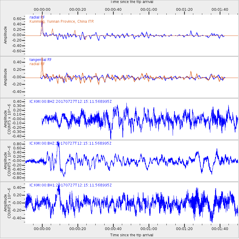
KMI Kunming, Yunnan Province, China - Earthquake Result Viewer
*The percent match for this event was below the threshold and hence no stack was calculated.
| Earthquake location: |
Buru, Indonesia |
| Earthquake latitude/longitude: |
-3.5/126.1 |
| Earthquake time(UTC): |
2017/07/27 (208) 12:08:38 GMT |
| Earthquake Depth: |
15 km |
| Earthquake Magnitude: |
5.8 Mww |
| Earthquake Catalog/Contributor: |
NEIC PDE/us |
|
| Network: |
IC New China Digital Seismograph Network |
| Station: |
KMI Kunming, Yunnan Province, China |
| Lat/Lon: |
25.12 N/102.74 E |
| Elevation: |
1975 m |
|
| Distance: |
36.4 deg |
| Az: |
322.774 deg |
| Baz: |
138.232 deg |
| Ray Param: |
$rayparam |
*The percent match for this event was below the threshold and hence was not used in the summary stack. |
|
| Radial Match: |
76.15556 % |
| Radial Bump: |
387 |
| Transverse Match: |
60.110374 % |
| Transverse Bump: |
400 |
| SOD ConfigId: |
2364251 |
| Insert Time: |
2017-10-09 17:06:56.081 +0000 |
| GWidth: |
2.5 |
| Max Bumps: |
400 |
| Tol: |
0.001 |
|
Signal To Noise
| Channel | StoN | STA | LTA |
| IC:KMI:00:BHZ:20170727T12:15:11.568995Z | 2.2406847 | 1.8339867E-7 | 8.1849386E-8 |
| IC:KMI:00:BH1:20170727T12:15:11.568995Z | 1.368536 | 1.1937831E-7 | 8.723067E-8 |
| IC:KMI:00:BH2:20170727T12:15:11.568995Z | 1.1601058 | 1.02691025E-7 | 8.851867E-8 |
| Arrivals |
| Ps | |
| PpPs | |
| PsPs/PpSs | |


