You are here: Home > Network List > IU - Global Seismograph Network (GSN - IRIS/USGS) Stations List
> Station WVT Waverly, Tennessee, USA > Earthquake Result Viewer
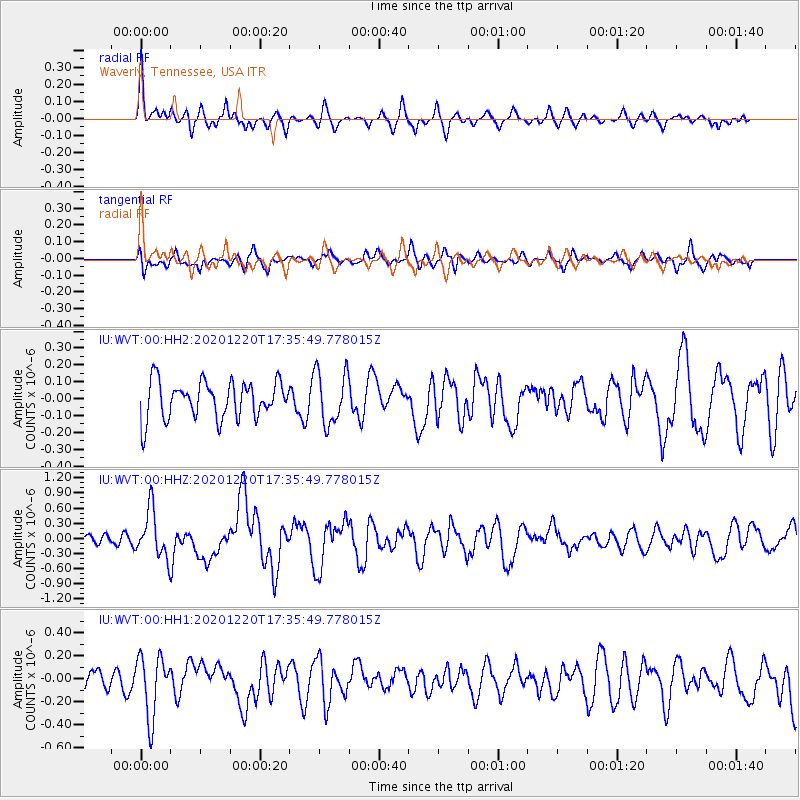
WVT Waverly, Tennessee, USA - Earthquake Result Viewer
*The percent match for this event was below the threshold and hence no stack was calculated.
| Earthquake location: |
Near East Coast Of Honshu, Japan |
| Earthquake latitude/longitude: |
40.8/142.5 |
| Earthquake time(UTC): |
2020/12/20 (355) 17:23:19 GMT |
| Earthquake Depth: |
10 km |
| Earthquake Magnitude: |
6.2 mww |
| Earthquake Catalog/Contributor: |
NEIC PDE/us |
|
| Network: |
IU Global Seismograph Network (GSN - IRIS/USGS) |
| Station: |
WVT Waverly, Tennessee, USA |
| Lat/Lon: |
36.13 N/87.83 W |
| Elevation: |
170 m |
|
| Distance: |
90.5 deg |
| Az: |
38.575 deg |
| Baz: |
324.239 deg |
| Ray Param: |
$rayparam |
*The percent match for this event was below the threshold and hence was not used in the summary stack. |
|
| Radial Match: |
60.440598 % |
| Radial Bump: |
326 |
| Transverse Match: |
48.97329 % |
| Transverse Bump: |
400 |
| SOD ConfigId: |
23341671 |
| Insert Time: |
2021-01-03 18:39:21.190 +0000 |
| GWidth: |
2.5 |
| Max Bumps: |
400 |
| Tol: |
0.001 |
|
Signal To Noise
| Channel | StoN | STA | LTA |
| IU:WVT:00:HHZ:20201220T17:35:49.778015Z | 3.4933088 | 4.697442E-7 | 1.344697E-7 |
| IU:WVT:00:HH1:20201220T17:35:49.778015Z | 2.5148854 | 2.6575168E-7 | 1.0567148E-7 |
| IU:WVT:00:HH2:20201220T17:35:49.778015Z | 1.446146 | 1.5751986E-7 | 1.089239E-7 |
| Arrivals |
| Ps | |
| PpPs | |
| PsPs/PpSs | |


