You are here: Home > Network List > IC - New China Digital Seismograph Network Stations List
> Station KMI Kunming, Yunnan Province, China > Earthquake Result Viewer
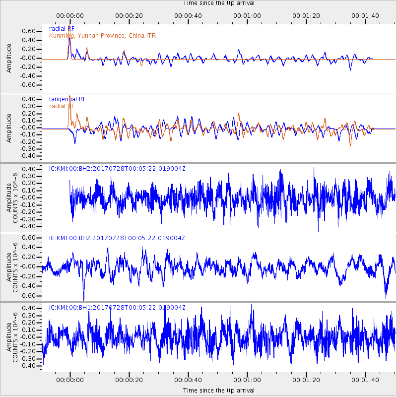
KMI Kunming, Yunnan Province, China - Earthquake Result Viewer
*The percent match for this event was below the threshold and hence no stack was calculated.
| Earthquake location: |
Southeast Of Honshu, Japan |
| Earthquake latitude/longitude: |
29.3/143.0 |
| Earthquake time(UTC): |
2017/07/27 (208) 23:58:52 GMT |
| Earthquake Depth: |
10 km |
| Earthquake Magnitude: |
5.3 Mww |
| Earthquake Catalog/Contributor: |
NEIC PDE/us |
|
| Network: |
IC New China Digital Seismograph Network |
| Station: |
KMI Kunming, Yunnan Province, China |
| Lat/Lon: |
25.12 N/102.74 E |
| Elevation: |
1975 m |
|
| Distance: |
35.9 deg |
| Az: |
273.138 deg |
| Baz: |
74.223 deg |
| Ray Param: |
$rayparam |
*The percent match for this event was below the threshold and hence was not used in the summary stack. |
|
| Radial Match: |
68.43965 % |
| Radial Bump: |
400 |
| Transverse Match: |
59.749733 % |
| Transverse Bump: |
400 |
| SOD ConfigId: |
2364251 |
| Insert Time: |
2017-10-09 17:15:20.897 +0000 |
| GWidth: |
2.5 |
| Max Bumps: |
400 |
| Tol: |
0.001 |
|
Signal To Noise
| Channel | StoN | STA | LTA |
| IC:KMI:00:BHZ:20170728T00:05:22.019004Z | 2.230774 | 2.0907243E-7 | 9.372193E-8 |
| IC:KMI:00:BH1:20170728T00:05:22.019004Z | 0.9640579 | 1.0318773E-7 | 1.07034786E-7 |
| IC:KMI:00:BH2:20170728T00:05:22.019004Z | 1.0148559 | 1.0109267E-7 | 9.9612826E-8 |
| Arrivals |
| Ps | |
| PpPs | |
| PsPs/PpSs | |


