You are here: Home > Network List > TA - USArray Transportable Network (new EarthScope stations) Stations List
> Station G21K Allakaket, AK, USA > Earthquake Result Viewer
G21K Allakaket, AK, USA - Earthquake Result Viewer

| Earthquake location: |
Near East Coast Of Honshu, Japan |
| Earthquake latitude/longitude: |
40.8/142.5 |
| Earthquake time(UTC): |
2020/12/20 (355) 17:23:19 GMT |
| Earthquake Depth: |
10 km |
| Earthquake Magnitude: |
6.2 mww |
| Earthquake Catalog/Contributor: |
NEIC PDE/us |
|
| Network: |
TA USArray Transportable Network (new EarthScope stations) |
| Station: |
G21K Allakaket, AK, USA |
| Lat/Lon: |
66.52 N/153.51 W |
| Elevation: |
446 m |
|
| Distance: |
43.1 deg |
| Az: |
31.807 deg |
| Baz: |
266.291 deg |
| Ray Param: |
0.07277683 |
| Estimated Moho Depth: |
35.0 km |
| Estimated Crust Vp/Vs: |
1.83 |
| Assumed Crust Vp: |
6.455 km/s |
| Estimated Crust Vs: |
3.537 km/s |
| Estimated Crust Poisson's Ratio: |
0.29 |
|
| Radial Match: |
93.599594 % |
| Radial Bump: |
400 |
| Transverse Match: |
89.483284 % |
| Transverse Bump: |
400 |
| SOD ConfigId: |
23341671 |
| Insert Time: |
2021-01-03 18:50:13.664 +0000 |
| GWidth: |
2.5 |
| Max Bumps: |
400 |
| Tol: |
0.001 |
|
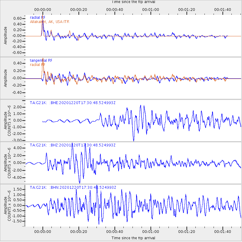
Signal To Noise
| Channel | StoN | STA | LTA |
| TA:G21K: :BHZ:20201220T17:30:48.524993Z | 8.527043 | 1.0741065E-6 | 1.259647E-7 |
| TA:G21K: :BHN:20201220T17:30:48.524993Z | 3.6649334 | 3.5055322E-7 | 9.565064E-8 |
| TA:G21K: :BHE:20201220T17:30:48.524993Z | 3.544147 | 5.0219614E-7 | 1.4169733E-7 |
| Arrivals |
| Ps | 4.8 SECOND |
| PpPs | 14 SECOND |
| PsPs/PpSs | 19 SECOND |


