You are here: Home > Network List > CI - Caltech Regional Seismic Network Stations List
> Station GLA Glamis, Glamis, CA, USA > Earthquake Result Viewer
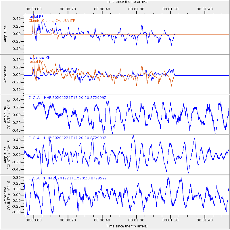
GLA Glamis, Glamis, CA, USA - Earthquake Result Viewer
*The percent match for this event was below the threshold and hence no stack was calculated.
| Earthquake location: |
Fiji Islands Region |
| Earthquake latitude/longitude: |
-16.4/-177.6 |
| Earthquake time(UTC): |
2020/12/21 (356) 17:08:56 GMT |
| Earthquake Depth: |
10 km |
| Earthquake Magnitude: |
5.7 Mww |
| Earthquake Catalog/Contributor: |
NEIC PDE/us |
|
| Network: |
CI Caltech Regional Seismic Network |
| Station: |
GLA Glamis, Glamis, CA, USA |
| Lat/Lon: |
33.05 N/114.83 W |
| Elevation: |
610 m |
|
| Distance: |
77.5 deg |
| Az: |
49.906 deg |
| Baz: |
240.961 deg |
| Ray Param: |
$rayparam |
*The percent match for this event was below the threshold and hence was not used in the summary stack. |
|
| Radial Match: |
54.98127 % |
| Radial Bump: |
400 |
| Transverse Match: |
41.891876 % |
| Transverse Bump: |
400 |
| SOD ConfigId: |
23341671 |
| Insert Time: |
2021-01-04 18:15:45.151 +0000 |
| GWidth: |
2.5 |
| Max Bumps: |
400 |
| Tol: |
0.001 |
|
Signal To Noise
| Channel | StoN | STA | LTA |
| CI:GLA: :HHZ:20201221T17:20:20.872999Z | 1.3705266 | 1.7036918E-7 | 1.2430928E-7 |
| CI:GLA: :HHN:20201221T17:20:20.872999Z | 0.8561101 | 1.6070156E-7 | 1.8771132E-7 |
| CI:GLA: :HHE:20201221T17:20:20.872999Z | 1.6970571 | 2.4465484E-7 | 1.4416418E-7 |
| Arrivals |
| Ps | |
| PpPs | |
| PsPs/PpSs | |


