You are here: Home > Network List > US - United States National Seismic Network Stations List
> Station MSO Missoula, Montana, USA > Earthquake Result Viewer
MSO Missoula, Montana, USA - Earthquake Result Viewer
*The percent match for this event was below the threshold and hence no stack was calculated.
| Earthquake location: |
Fiji Islands Region |
| Earthquake latitude/longitude: |
-16.4/-177.6 |
| Earthquake time(UTC): |
2020/12/21 (356) 17:08:56 GMT |
| Earthquake Depth: |
10 km |
| Earthquake Magnitude: |
5.7 Mww |
| Earthquake Catalog/Contributor: |
NEIC PDE/us |
|
| Network: |
US United States National Seismic Network |
| Station: |
MSO Missoula, Montana, USA |
| Lat/Lon: |
46.83 N/113.94 W |
| Elevation: |
1264 m |
|
| Distance: |
84.9 deg |
| Az: |
38.156 deg |
| Baz: |
239.728 deg |
| Ray Param: |
$rayparam |
*The percent match for this event was below the threshold and hence was not used in the summary stack. |
|
| Radial Match: |
59.426918 % |
| Radial Bump: |
400 |
| Transverse Match: |
61.804077 % |
| Transverse Bump: |
400 |
| SOD ConfigId: |
23341671 |
| Insert Time: |
2021-01-04 18:24:53.500 +0000 |
| GWidth: |
2.5 |
| Max Bumps: |
400 |
| Tol: |
0.001 |
|
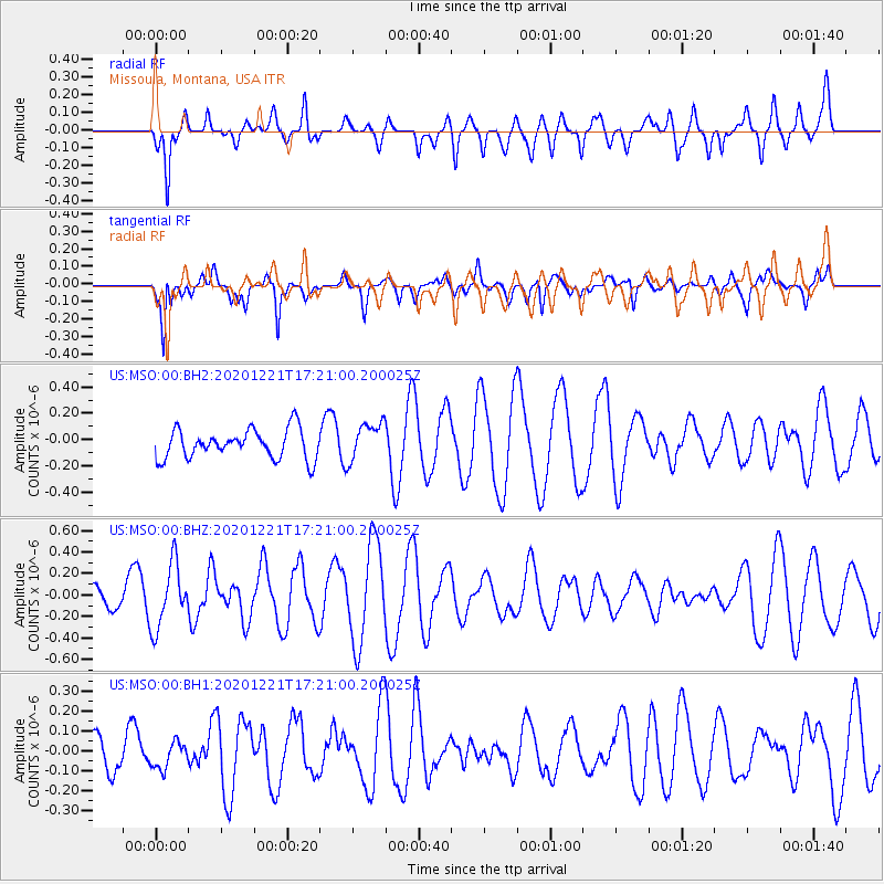
Signal To Noise
| Channel | StoN | STA | LTA |
| US:MSO:00:BHZ:20201221T17:21:00.200025Z | 2.6231902 | 2.950328E-7 | 1.1247099E-7 |
| US:MSO:00:BH1:20201221T17:21:00.200025Z | 0.51956844 | 6.591144E-8 | 1.2685804E-7 |
| US:MSO:00:BH2:20201221T17:21:00.200025Z | 1.3010237 | 1.4495771E-7 | 1.1141819E-7 |
| Arrivals |
| Ps | |
| PpPs | |
| PsPs/PpSs | |


