You are here: Home > Network List > AV - Alaska Volcano Observatory Stations List
> Station MAPS Pakushin Southeast, Makushin Volcano, Alaska > Earthquake Result Viewer
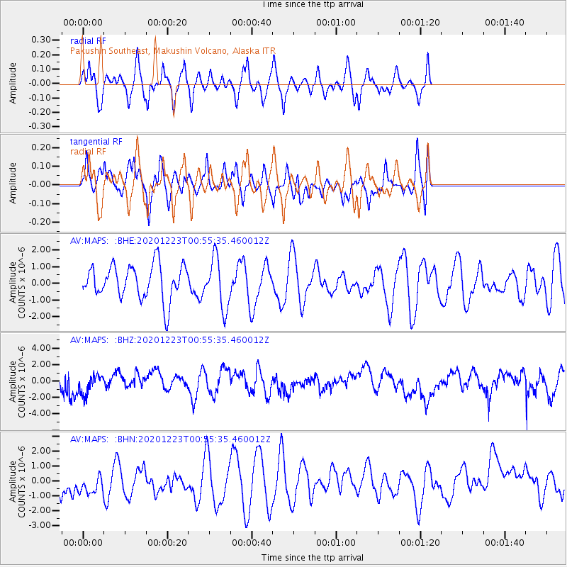
MAPS Pakushin Southeast, Makushin Volcano, Alaska - Earthquake Result Viewer
*The percent match for this event was below the threshold and hence no stack was calculated.
| Earthquake location: |
Northern East Pacific Rise |
| Earthquake latitude/longitude: |
8.4/-103.3 |
| Earthquake time(UTC): |
2020/12/23 (358) 00:45:08 GMT |
| Earthquake Depth: |
10 km |
| Earthquake Magnitude: |
5.6 Mww |
| Earthquake Catalog/Contributor: |
NEIC PDE/us |
|
| Network: |
AV Alaska Volcano Observatory |
| Station: |
MAPS Pakushin Southeast, Makushin Volcano, Alaska |
| Lat/Lon: |
53.81 N/166.94 W |
| Elevation: |
333 m |
|
| Distance: |
67.9 deg |
| Az: |
324.983 deg |
| Baz: |
106.786 deg |
| Ray Param: |
$rayparam |
*The percent match for this event was below the threshold and hence was not used in the summary stack. |
|
| Radial Match: |
43.60896 % |
| Radial Bump: |
335 |
| Transverse Match: |
37.109554 % |
| Transverse Bump: |
344 |
| SOD ConfigId: |
23341671 |
| Insert Time: |
2021-01-06 01:48:16.562 +0000 |
| GWidth: |
2.5 |
| Max Bumps: |
400 |
| Tol: |
0.001 |
|
Signal To Noise
| Channel | StoN | STA | LTA |
| AV:MAPS: :BHZ:20201223T00:55:35.460012Z | 0.8026306 | 1.2809222E-6 | 1.5959051E-6 |
| AV:MAPS: :BHN:20201223T00:55:35.460012Z | 1.3270196 | 1.1155012E-6 | 8.4060645E-7 |
| AV:MAPS: :BHE:20201223T00:55:35.460012Z | 1.498015 | 1.5390398E-6 | 1.0273861E-6 |
| Arrivals |
| Ps | |
| PpPs | |
| PsPs/PpSs | |


