You are here: Home > Network List > WY - Yellowstone Wyoming Seismic Network Stations List
> Station YHH Holmes Hill, YNP, WY, USA > Earthquake Result Viewer
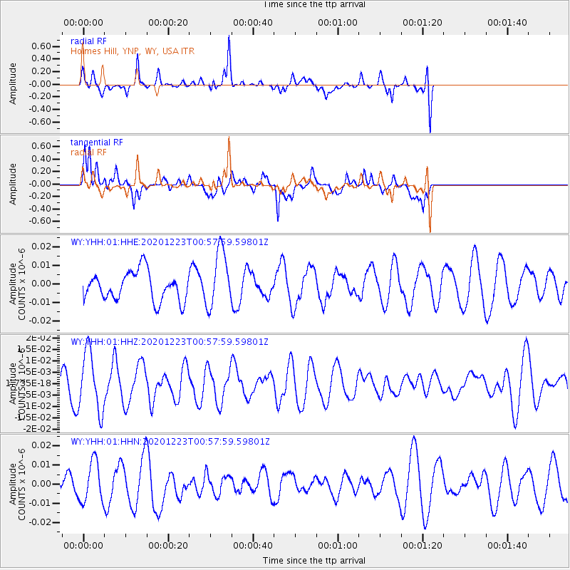
YHH Holmes Hill, YNP, WY, USA - Earthquake Result Viewer
*The percent match for this event was below the threshold and hence no stack was calculated.
| Earthquake location: |
Northern East Pacific Rise |
| Earthquake latitude/longitude: |
8.3/-103.2 |
| Earthquake time(UTC): |
2020/12/23 (358) 00:51:21 GMT |
| Earthquake Depth: |
10 km |
| Earthquake Magnitude: |
5.8 Mww |
| Earthquake Catalog/Contributor: |
NEIC PDE/us |
|
| Network: |
WY Yellowstone Wyoming Seismic Network |
| Station: |
YHH Holmes Hill, YNP, WY, USA |
| Lat/Lon: |
44.79 N/110.85 W |
| Elevation: |
2717 m |
|
| Distance: |
36.9 deg |
| Az: |
350.902 deg |
| Baz: |
167.306 deg |
| Ray Param: |
$rayparam |
*The percent match for this event was below the threshold and hence was not used in the summary stack. |
|
| Radial Match: |
60.4574 % |
| Radial Bump: |
400 |
| Transverse Match: |
69.63837 % |
| Transverse Bump: |
400 |
| SOD ConfigId: |
23341671 |
| Insert Time: |
2021-01-06 02:14:21.731 +0000 |
| GWidth: |
2.5 |
| Max Bumps: |
400 |
| Tol: |
0.001 |
|
Signal To Noise
| Channel | StoN | STA | LTA |
| WY:YHH:01:HHZ:20201223T00:57:59.59801Z | 2.0424998 | 1.3146508E-8 | 6.4364793E-9 |
| WY:YHH:01:HHN:20201223T00:57:59.59801Z | 1.1166661 | 1.0817378E-8 | 9.687209E-9 |
| WY:YHH:01:HHE:20201223T00:57:59.59801Z | 2.052104 | 1.5842447E-8 | 7.7201E-9 |
| Arrivals |
| Ps | |
| PpPs | |
| PsPs/PpSs | |


