You are here: Home > Network List > TA - USArray Transportable Network (new EarthScope stations) Stations List
> Station E20K Nigu River, AK, USA > Earthquake Result Viewer
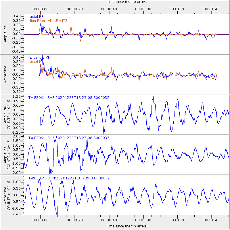
E20K Nigu River, AK, USA - Earthquake Result Viewer
*The percent match for this event was below the threshold and hence no stack was calculated.
| Earthquake location: |
W. Caroline Islands, Micronesia |
| Earthquake latitude/longitude: |
6.3/133.6 |
| Earthquake time(UTC): |
2020/12/23 (358) 18:11:47 GMT |
| Earthquake Depth: |
10 km |
| Earthquake Magnitude: |
5.9 mww |
| Earthquake Catalog/Contributor: |
NEIC PDE/us |
|
| Network: |
TA USArray Transportable Network (new EarthScope stations) |
| Station: |
E20K Nigu River, AK, USA |
| Lat/Lon: |
68.26 N/156.19 W |
| Elevation: |
866 m |
|
| Distance: |
76.9 deg |
| Az: |
21.091 deg |
| Baz: |
253.76 deg |
| Ray Param: |
$rayparam |
*The percent match for this event was below the threshold and hence was not used in the summary stack. |
|
| Radial Match: |
71.95725 % |
| Radial Bump: |
400 |
| Transverse Match: |
77.49926 % |
| Transverse Bump: |
400 |
| SOD ConfigId: |
23341671 |
| Insert Time: |
2021-01-06 19:20:32.954 +0000 |
| GWidth: |
2.5 |
| Max Bumps: |
400 |
| Tol: |
0.001 |
|
Signal To Noise
| Channel | StoN | STA | LTA |
| TA:E20K: :BHZ:20201223T18:23:08.800003Z | 1.3931569 | 8.289941E-7 | 5.9504714E-7 |
| TA:E20K: :BHN:20201223T18:23:08.800003Z | 2.463386 | 7.759041E-7 | 3.1497464E-7 |
| TA:E20K: :BHE:20201223T18:23:08.800003Z | 1.2439383 | 5.255491E-7 | 4.2248809E-7 |
| Arrivals |
| Ps | |
| PpPs | |
| PsPs/PpSs | |


