You are here: Home > Network List > TA - USArray Transportable Network (new EarthScope stations) Stations List
> Station I30M Mount Dempster, Yukon, CAN > Earthquake Result Viewer
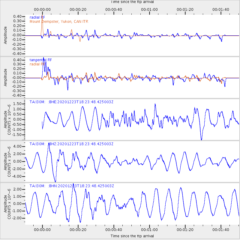
I30M Mount Dempster, Yukon, CAN - Earthquake Result Viewer
*The percent match for this event was below the threshold and hence no stack was calculated.
| Earthquake location: |
W. Caroline Islands, Micronesia |
| Earthquake latitude/longitude: |
6.3/133.6 |
| Earthquake time(UTC): |
2020/12/23 (358) 18:11:47 GMT |
| Earthquake Depth: |
10 km |
| Earthquake Magnitude: |
5.9 mww |
| Earthquake Catalog/Contributor: |
NEIC PDE/us |
|
| Network: |
TA USArray Transportable Network (new EarthScope stations) |
| Station: |
I30M Mount Dempster, Yukon, CAN |
| Lat/Lon: |
65.22 N/136.38 W |
| Elevation: |
1399 m |
|
| Distance: |
84.3 deg |
| Az: |
25.054 deg |
| Baz: |
272.624 deg |
| Ray Param: |
$rayparam |
*The percent match for this event was below the threshold and hence was not used in the summary stack. |
|
| Radial Match: |
48.640728 % |
| Radial Bump: |
400 |
| Transverse Match: |
67.31476 % |
| Transverse Bump: |
392 |
| SOD ConfigId: |
23341671 |
| Insert Time: |
2021-01-06 19:20:52.742 +0000 |
| GWidth: |
2.5 |
| Max Bumps: |
400 |
| Tol: |
0.001 |
|
Signal To Noise
| Channel | StoN | STA | LTA |
| TA:I30M: :BHZ:20201223T18:23:48.425003Z | 3.4141438 | 2.6394318E-6 | 7.730875E-7 |
| TA:I30M: :BHN:20201223T18:23:48.425003Z | 1.2866504 | 1.0622273E-6 | 8.255757E-7 |
| TA:I30M: :BHE:20201223T18:23:48.425003Z | 1.2547809 | 7.133946E-7 | 5.685412E-7 |
| Arrivals |
| Ps | |
| PpPs | |
| PsPs/PpSs | |


