You are here: Home > Network List > GS - US Geological Survey Networks Stations List
> Station DEC09 Decatur Surface Seismic Site, Decatur, IL, USA > Earthquake Result Viewer
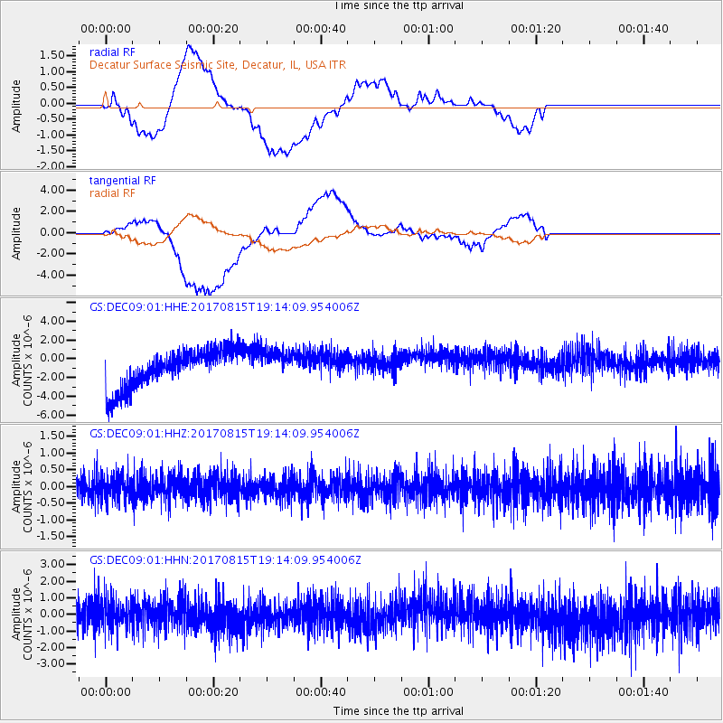
DEC09 Decatur Surface Seismic Site, Decatur, IL, USA - Earthquake Result Viewer
*The percent match for this event was below the threshold and hence no stack was calculated.
| Earthquake location: |
Off Coast Of Central Chile |
| Earthquake latitude/longitude: |
-30.0/-72.2 |
| Earthquake time(UTC): |
2017/08/15 (227) 19:03:21 GMT |
| Earthquake Depth: |
4.9 km |
| Earthquake Magnitude: |
5.5 mb |
| Earthquake Catalog/Contributor: |
NEIC PDE/us |
|
| Network: |
GS US Geological Survey Networks |
| Station: |
DEC09 Decatur Surface Seismic Site, Decatur, IL, USA |
| Lat/Lon: |
39.87 N/88.92 W |
| Elevation: |
207 m |
|
| Distance: |
71.2 deg |
| Az: |
346.461 deg |
| Baz: |
164.696 deg |
| Ray Param: |
$rayparam |
*The percent match for this event was below the threshold and hence was not used in the summary stack. |
|
| Radial Match: |
46.52344 % |
| Radial Bump: |
400 |
| Transverse Match: |
51.662422 % |
| Transverse Bump: |
400 |
| SOD ConfigId: |
2364251 |
| Insert Time: |
2017-10-09 18:40:13.221 +0000 |
| GWidth: |
2.5 |
| Max Bumps: |
400 |
| Tol: |
0.001 |
|
Signal To Noise
| Channel | StoN | STA | LTA |
| GS:DEC09:01:HHZ:20170815T19:14:09.954006Z | 0.77451664 | 3.6181964E-7 | 4.6715544E-7 |
| GS:DEC09:01:HHN:20170815T19:14:09.954006Z | 1.0150496 | 8.4784597E-7 | 8.352754E-7 |
| GS:DEC09:01:HHE:20170815T19:14:09.954006Z | 0.8117524 | 1.6292229E-6 | 2.0070443E-6 |
| Arrivals |
| Ps | |
| PpPs | |
| PsPs/PpSs | |


