You are here: Home > Network List > G - GEOSCOPE Stations List
> Station MPG Montagne des Peres, French Guyana > Earthquake Result Viewer
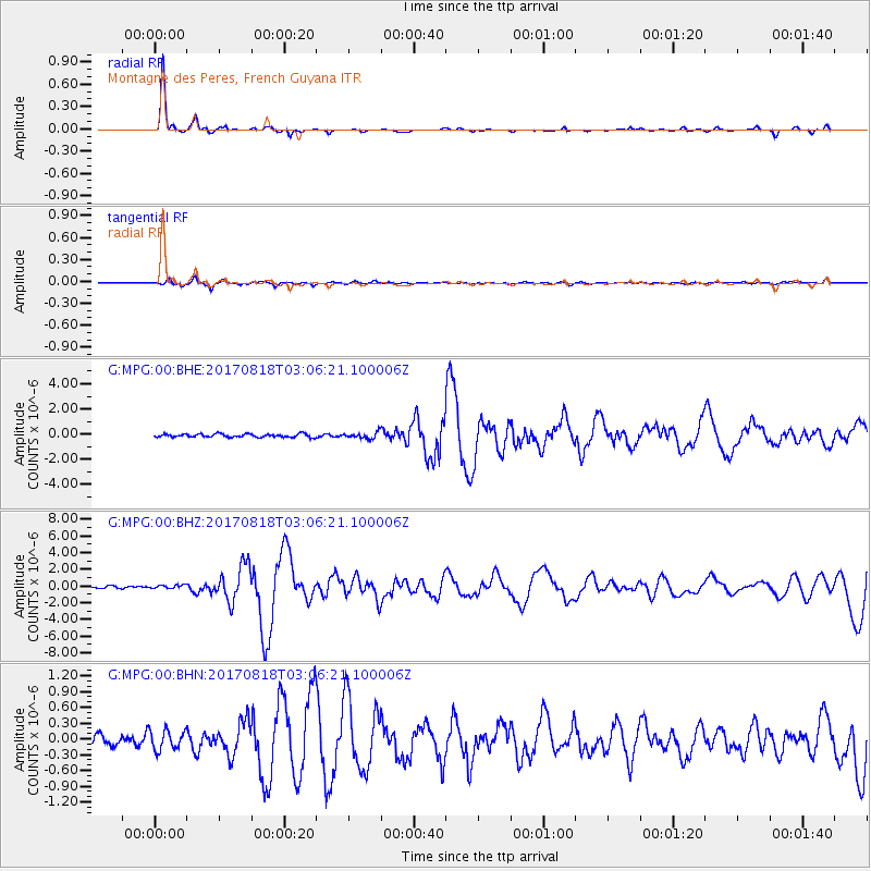
MPG Montagne des Peres, French Guyana - Earthquake Result Viewer
*The percent match for this event was below the threshold and hence no stack was calculated.
| Earthquake location: |
North Of Ascension Island |
| Earthquake latitude/longitude: |
-0.9/-13.9 |
| Earthquake time(UTC): |
2017/08/18 (230) 02:59:24 GMT |
| Earthquake Depth: |
19 km |
| Earthquake Magnitude: |
6.7 Mi |
| Earthquake Catalog/Contributor: |
NEIC PDE/pt |
|
| Network: |
G GEOSCOPE |
| Station: |
MPG Montagne des Peres, French Guyana |
| Lat/Lon: |
5.11 N/52.64 W |
| Elevation: |
147 m |
|
| Distance: |
39.2 deg |
| Az: |
279.128 deg |
| Baz: |
97.645 deg |
| Ray Param: |
$rayparam |
*The percent match for this event was below the threshold and hence was not used in the summary stack. |
|
| Radial Match: |
93.58484 % |
| Radial Bump: |
195 |
| Transverse Match: |
77.78359 % |
| Transverse Bump: |
400 |
| SOD ConfigId: |
2364251 |
| Insert Time: |
2017-10-09 18:46:09.322 +0000 |
| GWidth: |
2.5 |
| Max Bumps: |
400 |
| Tol: |
0.001 |
|
Signal To Noise
| Channel | StoN | STA | LTA |
| G:MPG:00:BHZ:20170818T03:06:21.100006Z | 1.4439805 | 2.1334641E-7 | 1.4774882E-7 |
| G:MPG:00:BHN:20170818T03:06:21.100006Z | 2.3705106 | 1.8723411E-7 | 7.898472E-8 |
| G:MPG:00:BHE:20170818T03:06:21.100006Z | 1.3115475 | 1.5624168E-7 | 1.1912774E-7 |
| Arrivals |
| Ps | |
| PpPs | |
| PsPs/PpSs | |


