You are here: Home > Network List > CN - Canadian National Seismograph Network Stations List
> Station INK INUVIK, NT > Earthquake Result Viewer
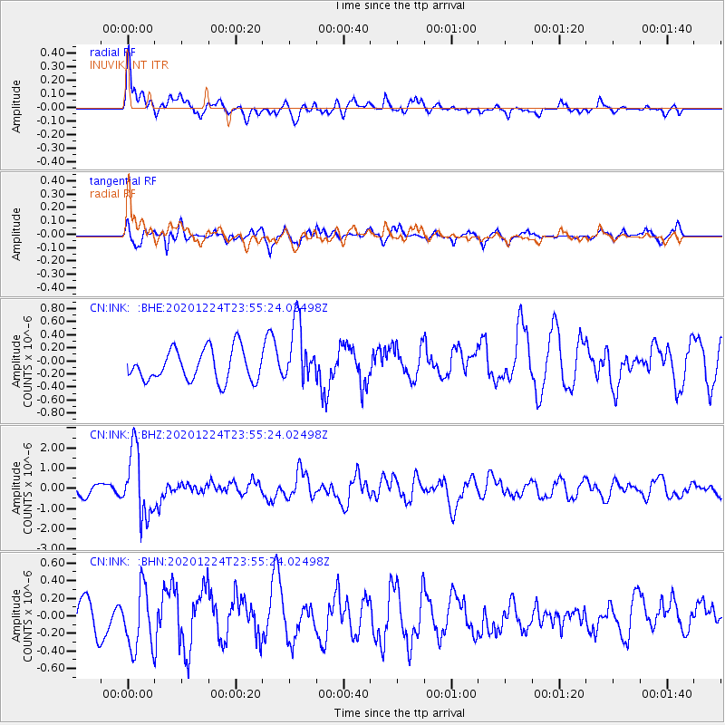
INK INUVIK, NT - Earthquake Result Viewer
*The percent match for this event was below the threshold and hence no stack was calculated.
| Earthquake location: |
Mindoro, Philippines |
| Earthquake latitude/longitude: |
13.8/120.6 |
| Earthquake time(UTC): |
2020/12/24 (359) 23:43:42 GMT |
| Earthquake Depth: |
114 km |
| Earthquake Magnitude: |
6.3 Mww |
| Earthquake Catalog/Contributor: |
NEIC PDE/us |
|
| Network: |
CN Canadian National Seismograph Network |
| Station: |
INK INUVIK, NT |
| Lat/Lon: |
68.31 N/133.53 W |
| Elevation: |
44 m |
|
| Distance: |
83.0 deg |
| Az: |
21.123 deg |
| Baz: |
289.677 deg |
| Ray Param: |
$rayparam |
*The percent match for this event was below the threshold and hence was not used in the summary stack. |
|
| Radial Match: |
63.09571 % |
| Radial Bump: |
400 |
| Transverse Match: |
59.026604 % |
| Transverse Bump: |
400 |
| SOD ConfigId: |
23341671 |
| Insert Time: |
2021-01-08 00:51:59.081 +0000 |
| GWidth: |
2.5 |
| Max Bumps: |
400 |
| Tol: |
0.001 |
|
Signal To Noise
| Channel | StoN | STA | LTA |
| CN:INK: :BHZ:20201224T23:55:24.02498Z | 7.1962934 | 1.6550251E-6 | 2.29983E-7 |
| CN:INK: :BHN:20201224T23:55:24.02498Z | 1.20535 | 3.5954503E-7 | 2.9829098E-7 |
| CN:INK: :BHE:20201224T23:55:24.02498Z | 1.9786524 | 4.7313787E-7 | 2.3912128E-7 |
| Arrivals |
| Ps | |
| PpPs | |
| PsPs/PpSs | |


