You are here: Home > Network List > IC - New China Digital Seismograph Network Stations List
> Station WMQ Urumqi, Xinjiang Province, China > Earthquake Result Viewer
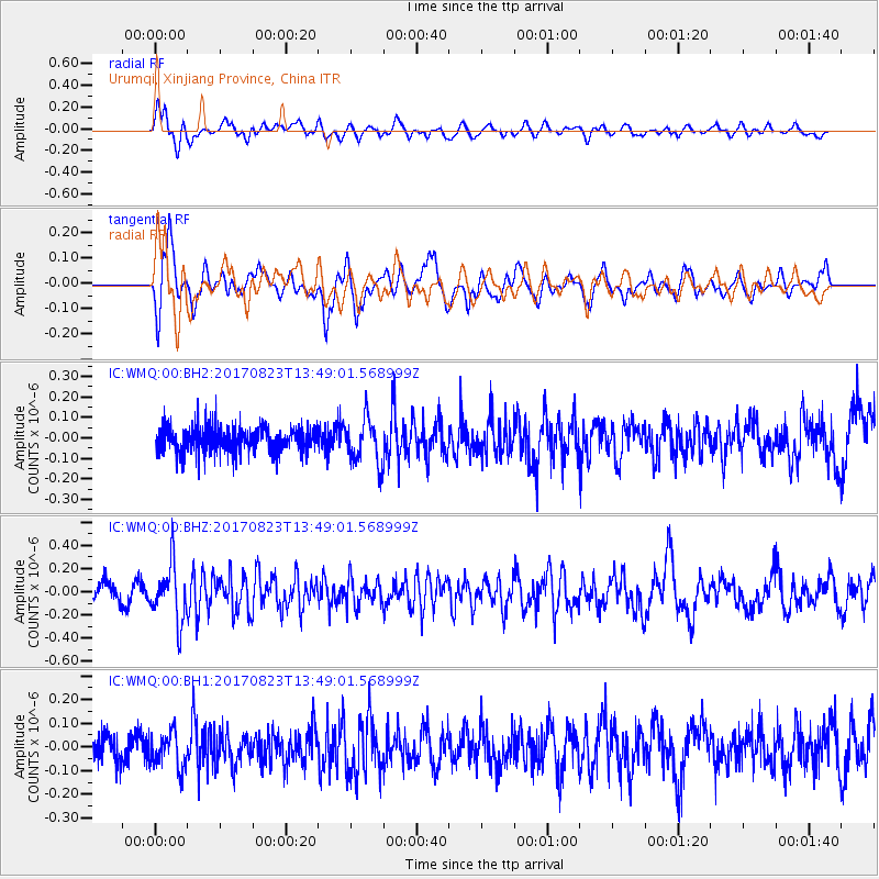
WMQ Urumqi, Xinjiang Province, China - Earthquake Result Viewer
*The percent match for this event was below the threshold and hence no stack was calculated.
| Earthquake location: |
Iran-Iraq Border Region |
| Earthquake latitude/longitude: |
36.2/45.0 |
| Earthquake time(UTC): |
2017/08/23 (235) 13:42:53 GMT |
| Earthquake Depth: |
10 km |
| Earthquake Magnitude: |
5.6 mb |
| Earthquake Catalog/Contributor: |
NEIC PDE/us |
|
| Network: |
IC New China Digital Seismograph Network |
| Station: |
WMQ Urumqi, Xinjiang Province, China |
| Lat/Lon: |
43.81 N/87.70 E |
| Elevation: |
850 m |
|
| Distance: |
33.3 deg |
| Az: |
63.397 deg |
| Baz: |
271.573 deg |
| Ray Param: |
$rayparam |
*The percent match for this event was below the threshold and hence was not used in the summary stack. |
|
| Radial Match: |
70.40933 % |
| Radial Bump: |
400 |
| Transverse Match: |
72.70377 % |
| Transverse Bump: |
400 |
| SOD ConfigId: |
2364251 |
| Insert Time: |
2017-10-09 18:53:14.529 +0000 |
| GWidth: |
2.5 |
| Max Bumps: |
400 |
| Tol: |
0.001 |
|
Signal To Noise
| Channel | StoN | STA | LTA |
| IC:WMQ:00:BHZ:20170823T13:49:01.568999Z | 2.5843723 | 2.3884823E-7 | 9.242021E-8 |
| IC:WMQ:00:BH1:20170823T13:49:01.568999Z | 1.0818259 | 7.551013E-8 | 6.979878E-8 |
| IC:WMQ:00:BH2:20170823T13:49:01.568999Z | 1.6174387 | 1.01954825E-7 | 6.303474E-8 |
| Arrivals |
| Ps | |
| PpPs | |
| PsPs/PpSs | |


