You are here: Home > Network List > IW - Intermountain West Stations List
> Station DLMT Dillon, Montana, USA > Earthquake Result Viewer
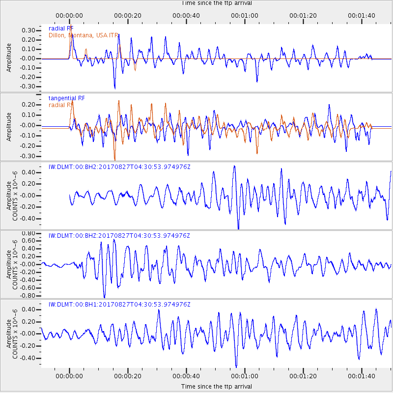
DLMT Dillon, Montana, USA - Earthquake Result Viewer
*The percent match for this event was below the threshold and hence no stack was calculated.
| Earthquake location: |
Admiralty Islands Region, P.N.G. |
| Earthquake latitude/longitude: |
-1.4/148.1 |
| Earthquake time(UTC): |
2017/08/27 (239) 04:17:51 GMT |
| Earthquake Depth: |
10 km |
| Earthquake Magnitude: |
6.6 Mi |
| Earthquake Catalog/Contributor: |
NEIC PDE/at |
|
| Network: |
IW Intermountain West |
| Station: |
DLMT Dillon, Montana, USA |
| Lat/Lon: |
45.36 N/112.60 W |
| Elevation: |
1569 m |
|
| Distance: |
97.5 deg |
| Az: |
44.571 deg |
| Baz: |
275.645 deg |
| Ray Param: |
$rayparam |
*The percent match for this event was below the threshold and hence was not used in the summary stack. |
|
| Radial Match: |
72.37146 % |
| Radial Bump: |
386 |
| Transverse Match: |
77.782906 % |
| Transverse Bump: |
400 |
| SOD ConfigId: |
2364251 |
| Insert Time: |
2017-10-09 18:58:38.625 +0000 |
| GWidth: |
2.5 |
| Max Bumps: |
400 |
| Tol: |
0.001 |
|
Signal To Noise
| Channel | StoN | STA | LTA |
| IW:DLMT:00:BHZ:20170827T04:30:53.974976Z | 1.3291795 | 7.661484E-8 | 5.76407E-8 |
| IW:DLMT:00:BH1:20170827T04:30:53.974976Z | 0.39889768 | 4.5605507E-8 | 1.14328834E-7 |
| IW:DLMT:00:BH2:20170827T04:30:53.974976Z | 1.7372242 | 1.2991484E-7 | 7.4783E-8 |
| Arrivals |
| Ps | |
| PpPs | |
| PsPs/PpSs | |


