You are here: Home > Network List > US - United States National Seismic Network Stations List
> Station HAWA Hanford, Washington, USA > Earthquake Result Viewer
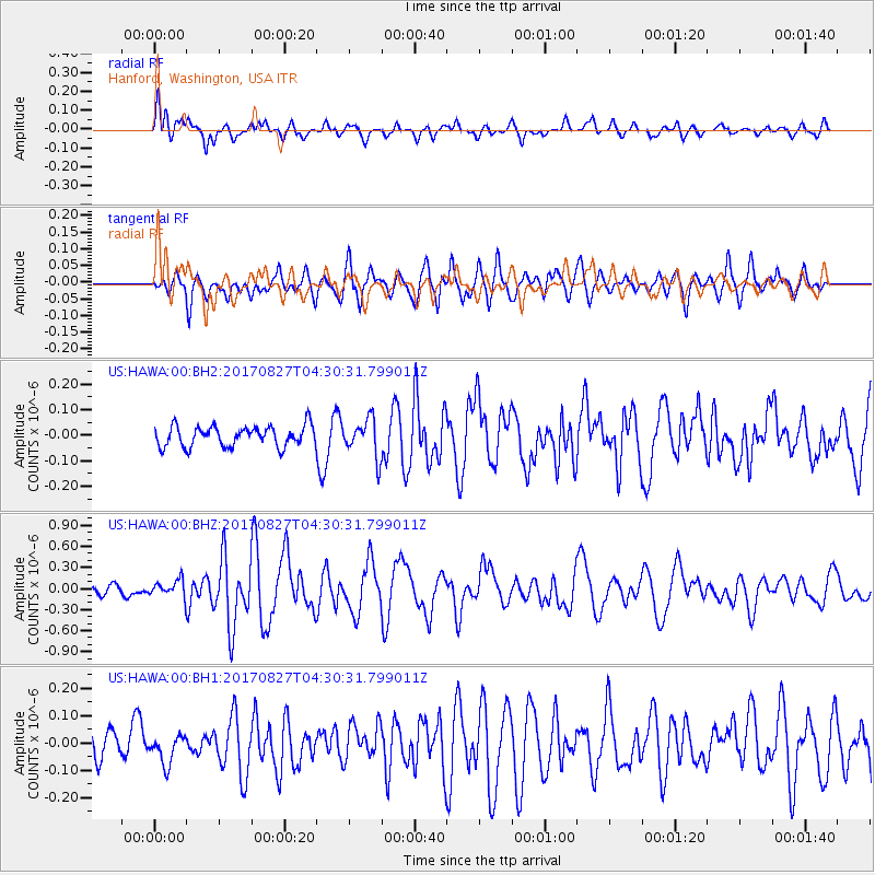
HAWA Hanford, Washington, USA - Earthquake Result Viewer
*The percent match for this event was below the threshold and hence no stack was calculated.
| Earthquake location: |
Admiralty Islands Region, P.N.G. |
| Earthquake latitude/longitude: |
-1.4/148.1 |
| Earthquake time(UTC): |
2017/08/27 (239) 04:17:51 GMT |
| Earthquake Depth: |
10 km |
| Earthquake Magnitude: |
6.6 Mi |
| Earthquake Catalog/Contributor: |
NEIC PDE/at |
|
| Network: |
US United States National Seismic Network |
| Station: |
HAWA Hanford, Washington, USA |
| Lat/Lon: |
46.39 N/119.53 W |
| Elevation: |
364 m |
|
| Distance: |
92.6 deg |
| Az: |
43.811 deg |
| Baz: |
270.746 deg |
| Ray Param: |
$rayparam |
*The percent match for this event was below the threshold and hence was not used in the summary stack. |
|
| Radial Match: |
76.263336 % |
| Radial Bump: |
400 |
| Transverse Match: |
65.96917 % |
| Transverse Bump: |
400 |
| SOD ConfigId: |
2364251 |
| Insert Time: |
2017-10-09 18:59:06.864 +0000 |
| GWidth: |
2.5 |
| Max Bumps: |
400 |
| Tol: |
0.001 |
|
Signal To Noise
| Channel | StoN | STA | LTA |
| US:HAWA:00:BHZ:20170827T04:30:31.799011Z | 2.2347825 | 1.2490287E-7 | 5.5890393E-8 |
| US:HAWA:00:BH1:20170827T04:30:31.799011Z | 0.9644006 | 5.1727486E-8 | 5.363693E-8 |
| US:HAWA:00:BH2:20170827T04:30:31.799011Z | 1.5355171 | 6.184092E-8 | 4.027368E-8 |
| Arrivals |
| Ps | |
| PpPs | |
| PsPs/PpSs | |


