You are here: Home > Network List > TA - USArray Transportable Network (new EarthScope stations) Stations List
> Station I30M Mount Dempster, Yukon, CAN > Earthquake Result Viewer
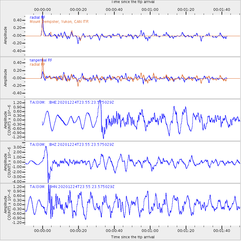
I30M Mount Dempster, Yukon, CAN - Earthquake Result Viewer
*The percent match for this event was below the threshold and hence no stack was calculated.
| Earthquake location: |
Mindoro, Philippines |
| Earthquake latitude/longitude: |
13.8/120.6 |
| Earthquake time(UTC): |
2020/12/24 (359) 23:43:42 GMT |
| Earthquake Depth: |
114 km |
| Earthquake Magnitude: |
6.3 Mww |
| Earthquake Catalog/Contributor: |
NEIC PDE/us |
|
| Network: |
TA USArray Transportable Network (new EarthScope stations) |
| Station: |
I30M Mount Dempster, Yukon, CAN |
| Lat/Lon: |
65.22 N/136.38 W |
| Elevation: |
1399 m |
|
| Distance: |
82.9 deg |
| Az: |
24.444 deg |
| Baz: |
287.466 deg |
| Ray Param: |
$rayparam |
*The percent match for this event was below the threshold and hence was not used in the summary stack. |
|
| Radial Match: |
73.654396 % |
| Radial Bump: |
400 |
| Transverse Match: |
56.41246 % |
| Transverse Bump: |
400 |
| SOD ConfigId: |
23341671 |
| Insert Time: |
2021-01-08 00:58:14.133 +0000 |
| GWidth: |
2.5 |
| Max Bumps: |
400 |
| Tol: |
0.001 |
|
Signal To Noise
| Channel | StoN | STA | LTA |
| TA:I30M: :BHZ:20201224T23:55:23.575029Z | 11.762146 | 2.1233814E-6 | 1.805267E-7 |
| TA:I30M: :BHN:20201224T23:55:23.575029Z | 1.8215894 | 5.2270934E-7 | 2.8695237E-7 |
| TA:I30M: :BHE:20201224T23:55:23.575029Z | 2.530765 | 8.3317957E-7 | 3.2922046E-7 |
| Arrivals |
| Ps | |
| PpPs | |
| PsPs/PpSs | |


