You are here: Home > Network List > TA - USArray Transportable Network (new EarthScope stations) Stations List
> Station L15K Ungalak Mountain, AK, USA > Earthquake Result Viewer
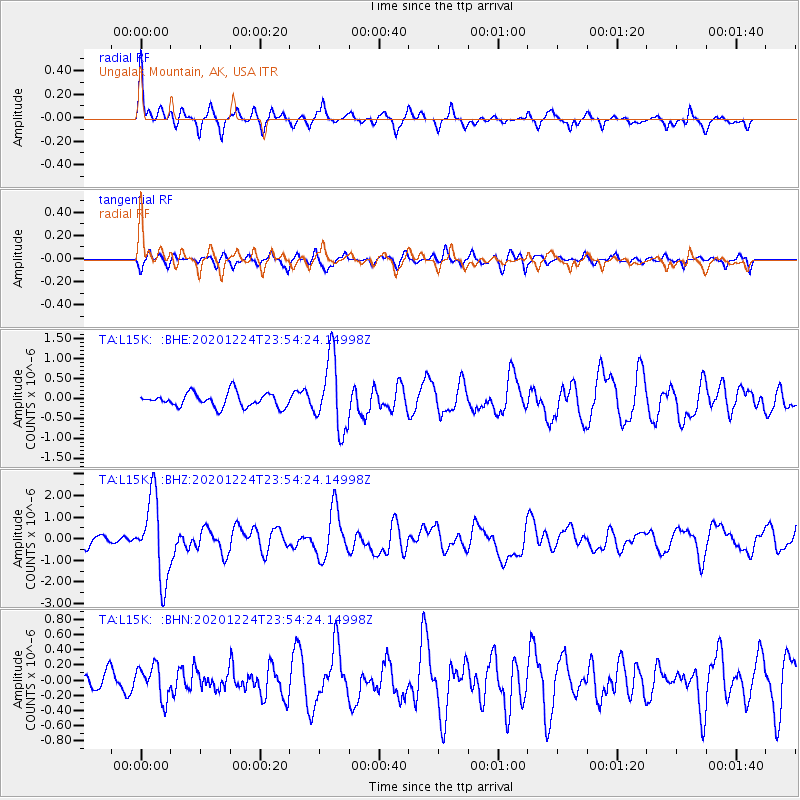
L15K Ungalak Mountain, AK, USA - Earthquake Result Viewer
*The percent match for this event was below the threshold and hence no stack was calculated.
| Earthquake location: |
Mindoro, Philippines |
| Earthquake latitude/longitude: |
13.8/120.6 |
| Earthquake time(UTC): |
2020/12/24 (359) 23:43:42 GMT |
| Earthquake Depth: |
114 km |
| Earthquake Magnitude: |
6.3 Mww |
| Earthquake Catalog/Contributor: |
NEIC PDE/us |
|
| Network: |
TA USArray Transportable Network (new EarthScope stations) |
| Station: |
L15K Ungalak Mountain, AK, USA |
| Lat/Lon: |
61.68 N/161.49 W |
| Elevation: |
219 m |
|
| Distance: |
72.2 deg |
| Az: |
29.323 deg |
| Baz: |
266.008 deg |
| Ray Param: |
$rayparam |
*The percent match for this event was below the threshold and hence was not used in the summary stack. |
|
| Radial Match: |
73.0098 % |
| Radial Bump: |
400 |
| Transverse Match: |
63.77486 % |
| Transverse Bump: |
368 |
| SOD ConfigId: |
23341671 |
| Insert Time: |
2021-01-08 00:58:25.107 +0000 |
| GWidth: |
2.5 |
| Max Bumps: |
400 |
| Tol: |
0.001 |
|
Signal To Noise
| Channel | StoN | STA | LTA |
| TA:L15K: :BHZ:20201224T23:54:24.14998Z | 8.134929 | 1.8790563E-6 | 2.3098622E-7 |
| TA:L15K: :BHN:20201224T23:54:24.14998Z | 0.7729612 | 2.1884813E-7 | 2.8312954E-7 |
| TA:L15K: :BHE:20201224T23:54:24.14998Z | 5.1686788 | 8.930645E-7 | 1.7278391E-7 |
| Arrivals |
| Ps | |
| PpPs | |
| PsPs/PpSs | |


