You are here: Home > Network List > CI - Caltech Regional Seismic Network Stations List
> Station GMR Granite Mountains Research Center > Earthquake Result Viewer
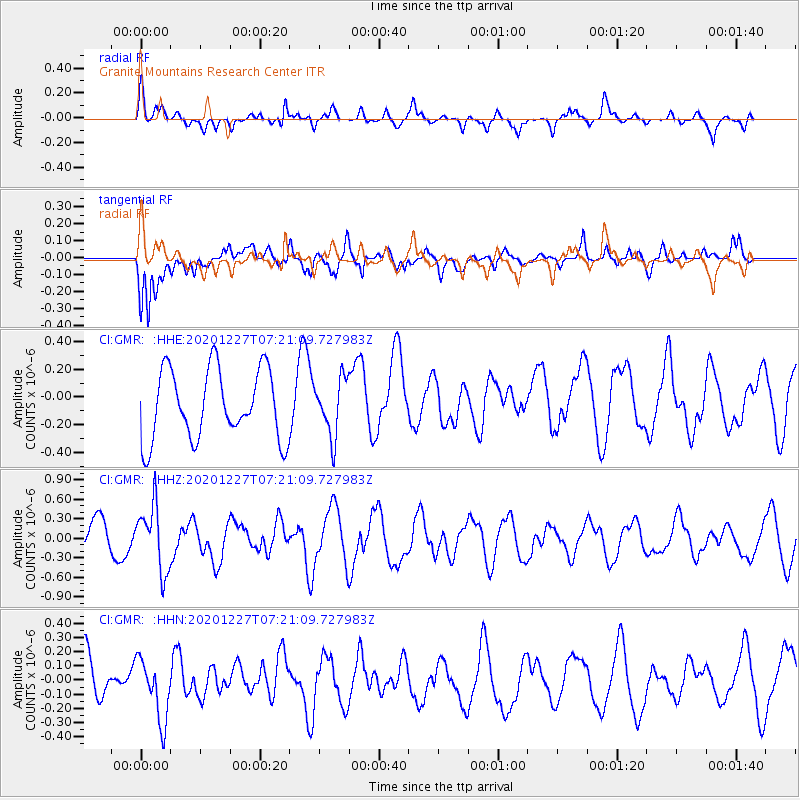
GMR Granite Mountains Research Center - Earthquake Result Viewer
*The percent match for this event was below the threshold and hence no stack was calculated.
| Earthquake location: |
Near Coast Of Peru |
| Earthquake latitude/longitude: |
-16.0/-74.3 |
| Earthquake time(UTC): |
2020/12/27 (362) 07:11:10 GMT |
| Earthquake Depth: |
34 km |
| Earthquake Magnitude: |
5.7 Mww |
| Earthquake Catalog/Contributor: |
NEIC PDE/us |
|
| Network: |
CI Caltech Regional Seismic Network |
| Station: |
GMR Granite Mountains Research Center |
| Lat/Lon: |
34.78 N/115.66 W |
| Elevation: |
1326 m |
|
| Distance: |
64.0 deg |
| Az: |
322.794 deg |
| Baz: |
135.055 deg |
| Ray Param: |
$rayparam |
*The percent match for this event was below the threshold and hence was not used in the summary stack. |
|
| Radial Match: |
71.54376 % |
| Radial Bump: |
400 |
| Transverse Match: |
55.946262 % |
| Transverse Bump: |
400 |
| SOD ConfigId: |
23341671 |
| Insert Time: |
2021-01-10 08:16:10.901 +0000 |
| GWidth: |
2.5 |
| Max Bumps: |
400 |
| Tol: |
0.001 |
|
Signal To Noise
| Channel | StoN | STA | LTA |
| CI:GMR: :HHZ:20201227T07:21:09.727983Z | 1.432872 | 5.037911E-7 | 3.5159533E-7 |
| CI:GMR: :HHN:20201227T07:21:09.727983Z | 1.0549425 | 2.1455675E-7 | 2.0338241E-7 |
| CI:GMR: :HHE:20201227T07:21:09.727983Z | 0.80533653 | 2.0327302E-7 | 2.5240755E-7 |
| Arrivals |
| Ps | |
| PpPs | |
| PsPs/PpSs | |


