You are here: Home > Network List > CI - Caltech Regional Seismic Network Stations List
> Station SMM Simmler, CA, USA > Earthquake Result Viewer
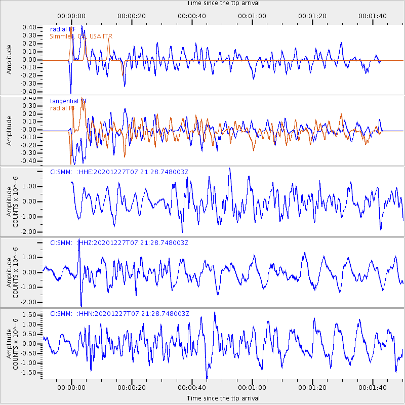
SMM Simmler, CA, USA - Earthquake Result Viewer
*The percent match for this event was below the threshold and hence no stack was calculated.
| Earthquake location: |
Near Coast Of Peru |
| Earthquake latitude/longitude: |
-16.0/-74.3 |
| Earthquake time(UTC): |
2020/12/27 (362) 07:11:10 GMT |
| Earthquake Depth: |
34 km |
| Earthquake Magnitude: |
5.7 Mww |
| Earthquake Catalog/Contributor: |
NEIC PDE/us |
|
| Network: |
CI Caltech Regional Seismic Network |
| Station: |
SMM Simmler, CA, USA |
| Lat/Lon: |
35.31 N/120.00 W |
| Elevation: |
599 m |
|
| Distance: |
66.9 deg |
| Az: |
320.532 deg |
| Baz: |
131.636 deg |
| Ray Param: |
$rayparam |
*The percent match for this event was below the threshold and hence was not used in the summary stack. |
|
| Radial Match: |
56.75315 % |
| Radial Bump: |
400 |
| Transverse Match: |
60.262947 % |
| Transverse Bump: |
400 |
| SOD ConfigId: |
23341671 |
| Insert Time: |
2021-01-10 08:16:55.172 +0000 |
| GWidth: |
2.5 |
| Max Bumps: |
400 |
| Tol: |
0.001 |
|
Signal To Noise
| Channel | StoN | STA | LTA |
| CI:SMM: :HHZ:20201227T07:21:28.748003Z | 2.3933938 | 8.684461E-7 | 3.6285132E-7 |
| CI:SMM: :HHN:20201227T07:21:28.748003Z | 1.1042928 | 3.9387703E-7 | 3.5667807E-7 |
| CI:SMM: :HHE:20201227T07:21:28.748003Z | 0.93354213 | 6.114497E-7 | 6.549782E-7 |
| Arrivals |
| Ps | |
| PpPs | |
| PsPs/PpSs | |


