You are here: Home > Network List > IU - Global Seismograph Network (GSN - IRIS/USGS) Stations List
> Station RSSD Black Hills, South Dakota, USA > Earthquake Result Viewer
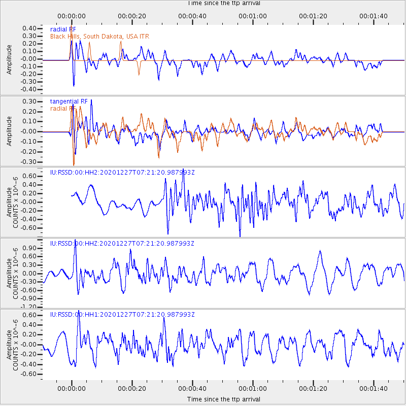
RSSD Black Hills, South Dakota, USA - Earthquake Result Viewer
*The percent match for this event was below the threshold and hence no stack was calculated.
| Earthquake location: |
Near Coast Of Peru |
| Earthquake latitude/longitude: |
-16.0/-74.3 |
| Earthquake time(UTC): |
2020/12/27 (362) 07:11:10 GMT |
| Earthquake Depth: |
34 km |
| Earthquake Magnitude: |
5.7 Mww |
| Earthquake Catalog/Contributor: |
NEIC PDE/us |
|
| Network: |
IU Global Seismograph Network (GSN - IRIS/USGS) |
| Station: |
RSSD Black Hills, South Dakota, USA |
| Lat/Lon: |
44.12 N/104.04 W |
| Elevation: |
2090 m |
|
| Distance: |
65.7 deg |
| Az: |
336.96 deg |
| Baz: |
148.497 deg |
| Ray Param: |
$rayparam |
*The percent match for this event was below the threshold and hence was not used in the summary stack. |
|
| Radial Match: |
61.760365 % |
| Radial Bump: |
400 |
| Transverse Match: |
47.03288 % |
| Transverse Bump: |
400 |
| SOD ConfigId: |
23341671 |
| Insert Time: |
2021-01-10 08:21:03.430 +0000 |
| GWidth: |
2.5 |
| Max Bumps: |
400 |
| Tol: |
0.001 |
|
Signal To Noise
| Channel | StoN | STA | LTA |
| IU:RSSD:00:HHZ:20201227T07:21:20.987993Z | 2.3073587 | 4.5475633E-7 | 1.9708958E-7 |
| IU:RSSD:00:HH1:20201227T07:21:20.987993Z | 1.8022485 | 3.2966244E-7 | 1.8291732E-7 |
| IU:RSSD:00:HH2:20201227T07:21:20.987993Z | 1.857481 | 3.2206052E-7 | 1.7338564E-7 |
| Arrivals |
| Ps | |
| PpPs | |
| PsPs/PpSs | |


