You are here: Home > Network List > IW - Intermountain West Stations List
> Station PLID Pearl Lake, Idaho, USA > Earthquake Result Viewer
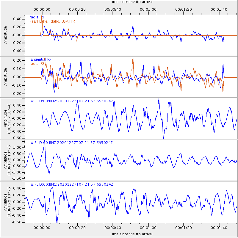
PLID Pearl Lake, Idaho, USA - Earthquake Result Viewer
*The percent match for this event was below the threshold and hence no stack was calculated.
| Earthquake location: |
Near Coast Of Peru |
| Earthquake latitude/longitude: |
-16.0/-74.3 |
| Earthquake time(UTC): |
2020/12/27 (362) 07:11:10 GMT |
| Earthquake Depth: |
34 km |
| Earthquake Magnitude: |
5.7 Mww |
| Earthquake Catalog/Contributor: |
NEIC PDE/us |
|
| Network: |
IW Intermountain West |
| Station: |
PLID Pearl Lake, Idaho, USA |
| Lat/Lon: |
45.09 N/116.00 W |
| Elevation: |
2164 m |
|
| Distance: |
71.6 deg |
| Az: |
330.254 deg |
| Baz: |
137.664 deg |
| Ray Param: |
$rayparam |
*The percent match for this event was below the threshold and hence was not used in the summary stack. |
|
| Radial Match: |
46.39786 % |
| Radial Bump: |
400 |
| Transverse Match: |
67.203156 % |
| Transverse Bump: |
400 |
| SOD ConfigId: |
23341671 |
| Insert Time: |
2021-01-10 08:21:14.509 +0000 |
| GWidth: |
2.5 |
| Max Bumps: |
400 |
| Tol: |
0.001 |
|
Signal To Noise
| Channel | StoN | STA | LTA |
| IW:PLID:00:BHZ:20201227T07:21:57.695024Z | 2.9489505 | 7.877293E-7 | 2.671219E-7 |
| IW:PLID:00:BH1:20201227T07:21:57.695024Z | 1.324973 | 1.909678E-7 | 1.4412957E-7 |
| IW:PLID:00:BH2:20201227T07:21:57.695024Z | 0.7785943 | 1.5596122E-7 | 2.0031128E-7 |
| Arrivals |
| Ps | |
| PpPs | |
| PsPs/PpSs | |


