You are here: Home > Network List > TX - Texas Seismological Network Stations List
> Station FW15 Z > Earthquake Result Viewer
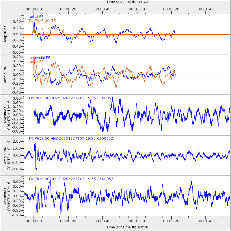
FW15 Z - Earthquake Result Viewer
*The percent match for this event was below the threshold and hence no stack was calculated.
| Earthquake location: |
Near Coast Of Peru |
| Earthquake latitude/longitude: |
-16.0/-74.3 |
| Earthquake time(UTC): |
2020/12/27 (362) 07:11:10 GMT |
| Earthquake Depth: |
34 km |
| Earthquake Magnitude: |
5.7 Mww |
| Earthquake Catalog/Contributor: |
NEIC PDE/us |
|
| Network: |
TX Texas Seismological Network |
| Station: |
FW15 Z |
| Lat/Lon: |
32.70 N/97.37 W |
| Elevation: |
192 m |
|
| Distance: |
53.2 deg |
| Az: |
335.69 deg |
| Baz: |
151.996 deg |
| Ray Param: |
$rayparam |
*The percent match for this event was below the threshold and hence was not used in the summary stack. |
|
| Radial Match: |
58.257103 % |
| Radial Bump: |
400 |
| Transverse Match: |
48.657593 % |
| Transverse Bump: |
400 |
| SOD ConfigId: |
23341671 |
| Insert Time: |
2021-01-10 08:30:38.503 +0000 |
| GWidth: |
2.5 |
| Max Bumps: |
400 |
| Tol: |
0.001 |
|
Signal To Noise
| Channel | StoN | STA | LTA |
| TX:FW15:00:HHZ:20201227T07:19:55.050005Z | 5.6596775 | 1.0405472E-6 | 1.8385272E-7 |
| TX:FW15:00:HH1:20201227T07:19:55.050005Z | 2.045882 | 4.6542735E-7 | 2.2749472E-7 |
| TX:FW15:00:HH2:20201227T07:19:55.050005Z | 1.8865082 | 3.4447737E-7 | 1.8260052E-7 |
| Arrivals |
| Ps | |
| PpPs | |
| PsPs/PpSs | |


